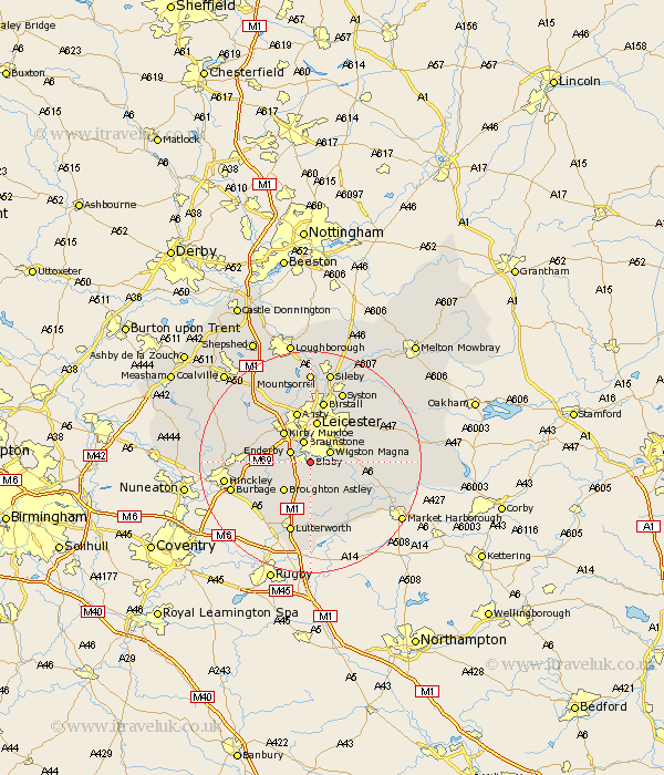
Leicestershire Map Showing Location of Blaby
Population: 6414
Area Size (ha): 122
District: Blaby
Easting: 457607 Northing: 296920
Latitude: 52.57 Longitude: -1.15
 = Blaby
Area Size (ha): 122
District: Blaby
Easting: 457607 Northing: 296920
Latitude: 52.57 Longitude: -1.15
= Blaby
This Blaby map below is supplied by Google. Use the tools in the top left corner to zoom into street level or zoom out for a road map, you may also need to zoom in to see Blaby on the map. Click and drag the map to move around. If the map fails to load try and refresh your browser or zoom in or out (+ or -).
Update - it seems Google no longer allow people to use their maps for free! This Blaby map sometimes loads and sometimes gives a error. I am working on a solution.
Closest 30 Towns or Cities to Blaby (Population over 500)
Countesthorpe 2.17km Glen Parka 2.25km Glen Parva 2.25km Whetstone 2.25km Cosby 2.92km Narborough 3.38km Wigston 3.85km Wigston Magna 3.85km Enderby 3.85km Braunstone 3.87km Oadby 4.87km Croft 5.93km Kirby Muxloe 7.15km Broughton Astley 7.16km Leicester 7.49km Leiscester 7.49km Great Glen 7.89km Stoney Stanton 8.72km Anstey 9.53km Ansty 9.53km Sapcote 9.65km Elmesthorpe 10.31km Elmsthorpe 10.31km Desford 10.58km Sharnford 10.59km Gilmarton 11.12km Gilmorton 11.12km Birstall 11.34km Walton 11.35km Walton-in-Knaptoft 11.35km