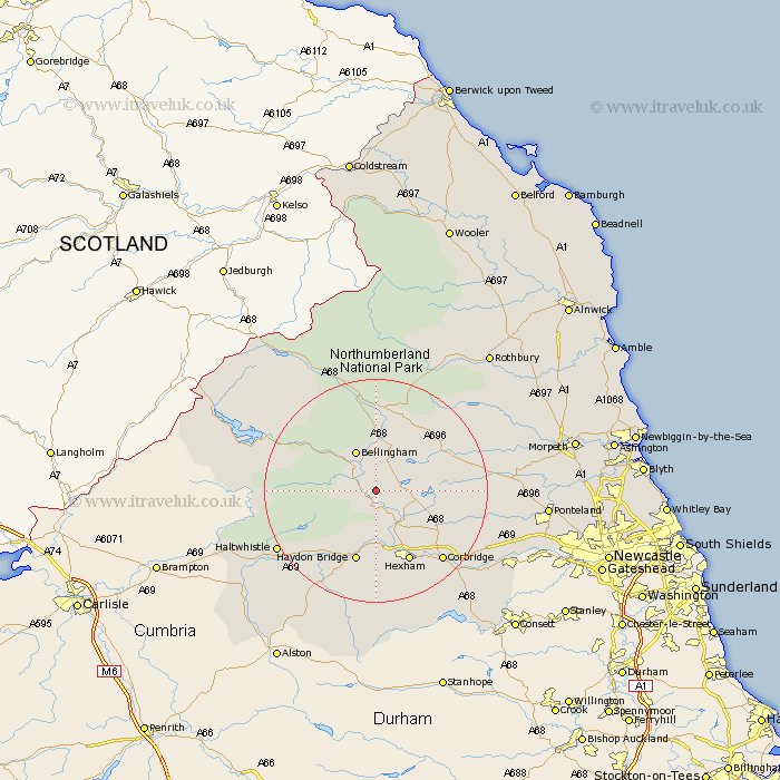
Northumberland Map Showing Location of Birtley
Population: 167
District: Tynedale
Easting: 388298 Northing: 576561
Latitude: 55.08 Longitude: -2.18
 = Birtley
District: Tynedale
Easting: 388298 Northing: 576561
Latitude: 55.08 Longitude: -2.18
= Birtley
This Birtley map below is supplied by Google. Use the tools in the top left corner to zoom into street level or zoom out for a road map, you may also need to zoom in to see Birtley on the map. Click and drag the map to move around. If the map fails to load try and refresh your browser or zoom in or out (+ or -).
Update - it seems Google no longer allow people to use their maps for free! This Birtley map sometimes loads and sometimes gives a error. I am working on a solution.
Closest 30 Towns or Cities to Birtley (Population over 500)
Wark 2.81km Humshaugh 6.41km Chollerton 7.69km Challerton 7.69km Bellingham 8.07km Newbrough 9.26km Warden 11.57km Acomb 12.32km Haydon Bridge 13.35km Sandhoe 13.99km Hexham 14.01km Otterburn 14.87km Corbridge 16.76km Haltwhistle 19.43km Stamfordham 20.92km Riding 21.66km Ridingmill 21.66km Slaley 22.52km Stocksfield 23.82km Ovingham 23.99km Wylam 24.89km Prudhoe 25.91km Ponteland 27.84km Longhorsley 31.29km Newburn 31.48km Rothbury 31.57km Dinnington 32.05km Woolsington 32.7km Stannington 32.93km Morpeth 33.11km