Norfolk Map Showing Location of Binham
Population: 273
District: North Norfolk
Easting: 598313 Northing: 339585
Latitude: 52.92 Longitude: 0.95
 = Binham
District: North Norfolk
Easting: 598313 Northing: 339585
Latitude: 52.92 Longitude: 0.95
= Binham
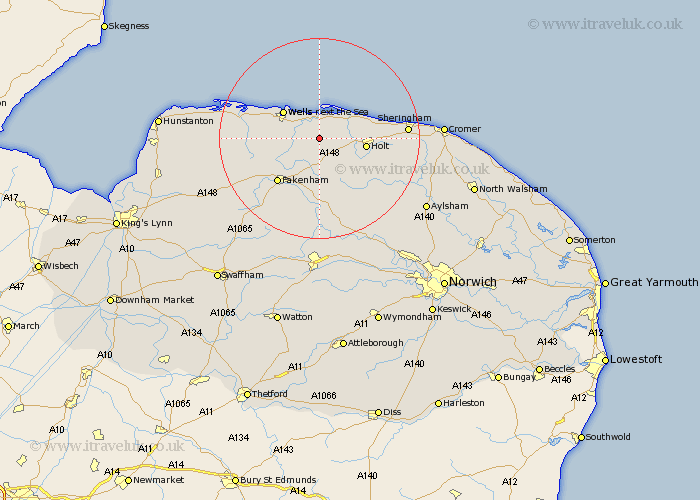
This Binham map below is supplied by Google. Use the tools in the top left corner to zoom into street level or zoom out for a road map, you may also need to zoom in to see Binham on the map. Click and drag the map to move around. If the map fails to load try and refresh your browser or zoom in or out (+ or -).
Update - it seems Google no longer allow people to use their maps for free! This Binham map sometimes loads and sometimes gives a error. I am working on a solution.
Closest 30 Towns or Cities to Binham (Population over 500)
Walsingham 5.81km Little Walsingham 5.81km Blakeney 6.49km Little Snoring 8.14km Wells-on-Sea 8.71km Wells on Sea 8.71km Wells-next-the-Sea 8.71km Wells next the Sea 8.71km Wells 8.71km Holt 9.13km Mellon Constable 9.29km Melton Constable 9.29km Briston 10.78km Ryburgh 11.34km Great Ryburgh 11.34km Sculthorpe 11.62km Hindolveston 11.99km Fakenham 12.14km South Creake 12.85km Weybourne 13.53km Colkirk 14.61km Burnham Market 14.99km Foulham 15.49km Foulsham 15.49km Corpusty 16.59km Sheringham 16.86km Tattersett 17.25km Tatterset 17.25km Syderstone 17.32km East Rudham 19.21km