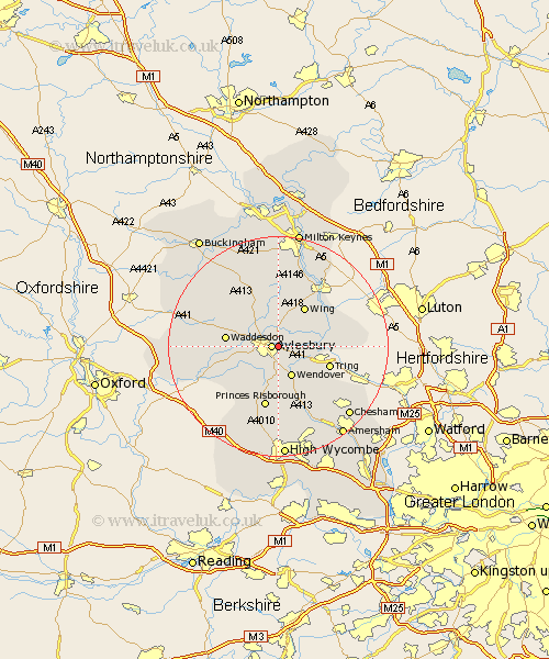
Buckinghamshire Map Showing Location of Bierton
District: Aylesbury Vale
Easting: 483856 Northing: 213868
Latitude: 51.82 Longitude: -0.78
 = Bierton
Easting: 483856 Northing: 213868
Latitude: 51.82 Longitude: -0.78
= Bierton
This Bierton map below is supplied by Google. Use the tools in the top left corner to zoom into street level or zoom out for a road map, you may also need to zoom in to see Bierton on the map. Click and drag the map to move around. If the map fails to load try and refresh your browser or zoom in or out (+ or -).
Update - it seems Google no longer allow people to use their maps for free! This Bierton map sometimes loads and sometimes gives a error. I am working on a solution.
Closest 30 Towns or Cities to Bierton (Population over 500)
Aylesbury 1.15km Stoke Mandeville 3.71km Weston Turville 4.36km Aston Clinton 4.94km Buckland 4.94km Stone 4.95km Halton 5.06km Wendover 6.02km Ellesborough 7.42km Marsworth 8.02km Whitechurch 8.16km Whitchurch 8.16km Cheddington 8.23km Wing 8.71km Kimble 9.34km Great Kimble 9.34km Waddesdon 9.35km North Marston 9.36km Cuddington 9.89km Longwick 10.35km Quainton 10.71km Haddenham 10.72km Stewkley 11.35km Princes Risborough 11.35km Pitstone 11.46km Ivinghoe 11.6km Slapton 11.71km Bledlow 12.51km Chearsley 12.74km Lee 13.08km