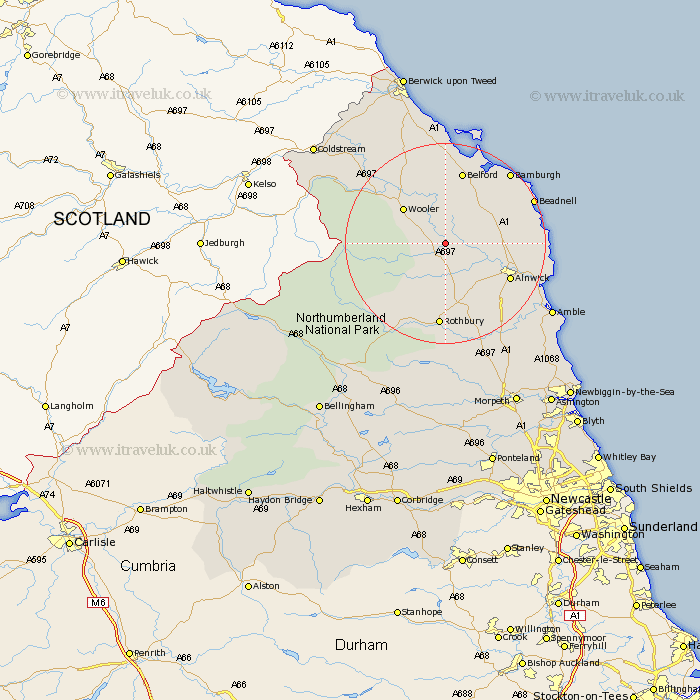
Northumberland Map Showing Location of Bewick
Population: 69
District: Berwick-upon-Tweed
Easting: 407375 Northing: 619215
Latitude: 55.47 Longitude: -1.88
 = Bewick
District: Berwick-upon-Tweed
Easting: 407375 Northing: 619215
Latitude: 55.47 Longitude: -1.88
= Bewick
This Bewick map below is supplied by Google. Use the tools in the top left corner to zoom into street level or zoom out for a road map, you may also need to zoom in to see Bewick on the map. Click and drag the map to move around. If the map fails to load try and refresh your browser or zoom in or out (+ or -).
Update - it seems Google no longer allow people to use their maps for free! This Bewick map sometimes loads and sometimes gives a error. I am working on a solution.
Closest 30 Towns or Cities to Bewick (Population over 500)
Wooler 10.43km Alnwick 13.74km Almwick 13.74km Belford 15.15km Rothbury 16.71km Shilbottle 16.82km Embleton 16.91km North Sunderland 17.6km Beadnell 18.27km Lesbury 19.21km Lisburg 19.21km Lowick 19.25km Alnmouth 19.35km Swarland 20.82km Warkworth 21.26km Longframlington 21.35km Felton 23.45km East Thirston 23.99km Thirston 23.99km Amble 24.06km Ancroft 26.96km Longhorsley 26.98km East Chevington 27.84km Norham 32.46km Ord 32.6km East Ord 32.6km Otterburn 33.07km Hebron 33.96km Ellington 34.26km Lynemouth 35.49km