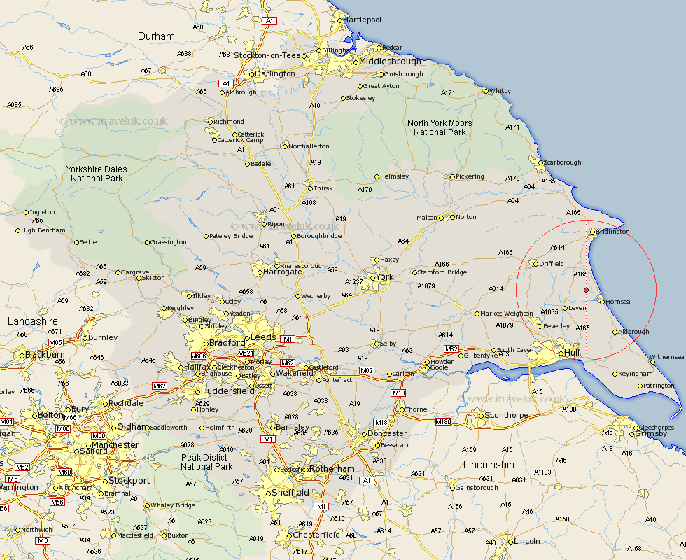
Yorkshire Map Showing Location of Bewholme
Population: 230
Easting: 515972 Northing: 450042
Latitude: 53.93 Longitude: -0.23
 = Bewholme
Easting: 515972 Northing: 450042
Latitude: 53.93 Longitude: -0.23
= Bewholme
This Bewholme map below is supplied by Google. Use the tools in the top left corner to zoom into street level or zoom out for a road map, you may also need to zoom in to see Bewholme on the map. Click and drag the map to move around. If the map fails to load try and refresh your browser or zoom in or out (+ or -).
Update - it seems Google no longer allow people to use their maps for free! This Bewholme map sometimes loads and sometimes gives a error. I am working on a solution.
Closest 30 Towns or Cities to Bewholme (Population over 500)
Dunnington 2.15km Skipsea 3.87km Beeford 4.31km Brandesburton 4.74km Brandsburton 4.74km Hornsea 5.73km Leven 7.79km Tickton 12.31km Skirlaugh Station 13.01km Cranswick 13.22km Nafferton 13.5km Aldbrough 15.05km Driffield 15.42km Kilham 15.63km Leckonfield 16.01km Leconfield 16.01km Woodmansey 16.27km Beverley 16.37km Wawne 16.68km North Frodingham 16.78km Lockington 16.79km Sproatley 17km Sutton on Hull 17.55km Sutton 17.55km Sutton-on-Hull 17.55km Walkington 17.68km Bridlington 18.06km Preston 18.65km Cherry Burton 18.98km Cottingham 19.36km