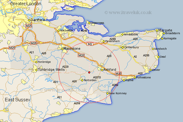
Kent Map Showing Location of Bethersden
Population: 1443
District: Ashford
Easting: 593614 Northing: 138966
Latitude: 51.12 Longitude: 0.77
 = Bethersden
District: Ashford
Easting: 593614 Northing: 138966
Latitude: 51.12 Longitude: 0.77
= Bethersden
This Bethersden map below is supplied by Google. Use the tools in the top left corner to zoom into street level or zoom out for a road map, you may also need to zoom in to see Bethersden on the map. Click and drag the map to move around. If the map fails to load try and refresh your browser or zoom in or out (+ or -).
Update - it seems Google no longer allow people to use their maps for free! This Bethersden map sometimes loads and sometimes gives a error. I am working on a solution.
Closest 30 Towns or Cities to Bethersden (Population over 500)
Shadoxhurst 3.95km Hothfield 5.09km High Halden 5.1km Woodchurch 5.56km Smarden 6.1km Kingsnorth 6.11km Tenterden 7.31km Pluckley 7.5km Egerton 7.76km Orlestone 8.05km Ashford 8.35km Kennington 8.94km Ham Street 9.43km Biddenden 9.49km Charing 9.55km Ruckinge 11.02km Rockinge 11.02km Headcorn 11.1km Hinxhill 11.78km Mersham 11.78km Ulcombe 12.33km Frittenden 12.93km Rolvenden 13.14km Aldington 13.33km Lenham 13.43km Wye 13.78km Wittersham 13.79km Smeeth 13.96km Harrietsham 14.21km Beneden 14.8km