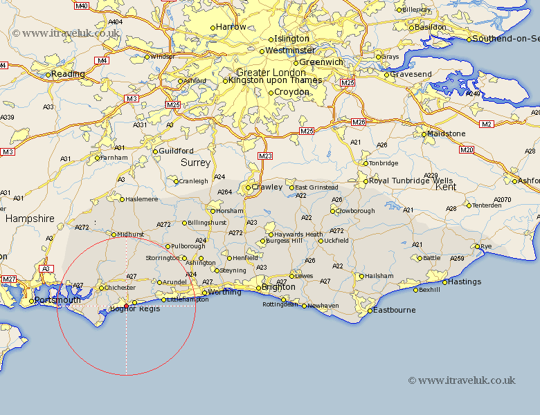
Sussex Map Showing Location of Bersted
Population: 8443
District: Arun
Easting: 492809 Northing: 99080
Latitude: 50.78 Longitude: -0.68
 = Bersted
District: Arun
Easting: 492809 Northing: 99080
Latitude: 50.78 Longitude: -0.68
= Bersted
This Bersted map below is supplied by Google. Use the tools in the top left corner to zoom into street level or zoom out for a road map, you may also need to zoom in to see Bersted on the map. Click and drag the map to move around. If the map fails to load try and refresh your browser or zoom in or out (+ or -).
Update - it seems Google no longer allow people to use their maps for free! This Bersted map sometimes loads and sometimes gives a error. I am working on a solution.
Closest 30 Towns or Cities to Bersted (Population over 500)
Bognor 2.34km Felpham 2.34km Bognor Regis 2.59km Middleton 4.69km Middleton on Sea 4.69km Middleton-on-Sea 4.69km Pagham 5.04km North Mundham 5.04km Mundham 5.04km Westergate 5.05km Barnham 5.11km Oving 6.03km Eastergate 6.03km Yapton 6.14km Sidlesham 7.03km Dunnington 7.27km Donnington 7.27km Boxgrove 7.78km Tangmere 7.78km Ford 7.95km Slindon 8.21km Walberton 8.77km Chichester 8.96km Selsey 8.97km Fishbourne 9.91km Lavant 10.22km Birdham 10.55km Littlehampton 10.71km Arundel 11.95km Rustington 13.02km