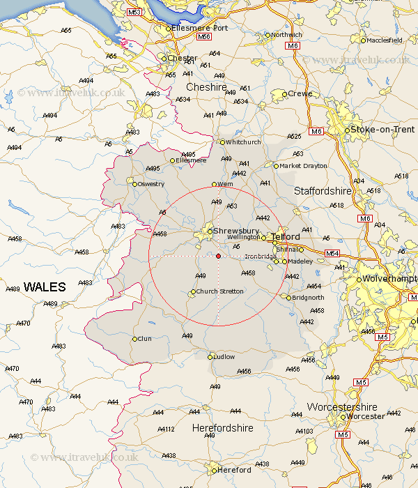
Shropshire Map Showing Location of Berrington
Population: 805
District: Shrewsbury and Atcham
Easting: 352648 Northing: 306076
Latitude: 52.65 Longitude: -2.7
 = Berrington
District: Shrewsbury and Atcham
Easting: 352648 Northing: 306076
Latitude: 52.65 Longitude: -2.7
= Berrington
This Berrington map below is supplied by Google. Use the tools in the top left corner to zoom into street level or zoom out for a road map, you may also need to zoom in to see Berrington on the map. Click and drag the map to move around. If the map fails to load try and refresh your browser or zoom in or out (+ or -).
Update - it seems Google no longer allow people to use their maps for free! This Berrington map sometimes loads and sometimes gives a error. I am working on a solution.
Closest 30 Towns or Cities to Berrington (Population over 500)
Condover 3.37km Baystonhill 3.85km Cressage 5.92km Shrewsbury 7.75km Hanwood 8.7km Great Hanwood 8.7km Wrockwardine 10.57km Rodington 10.83km Much Wenlock 11.55km Bicton 12.15km Pontesbury 12.37km Ford 12.54km High Ercall 13km Ercall Magna 13km Church Stretton 13.01km Hadnall 13.02km Wellington 13.55km Rushbury 14.87km Broseley 15.08km Shawbury 15.2km Ketley 15.63km Hadley 15.63km Telford 15.8km Dawley 15.85km Minsterley 15.85km Ironbridge 15.85km Barrow 16.7km Barrow Bridge 16.7km Westbury 17.26km Trench 17.39km