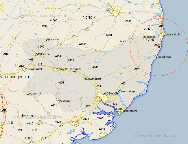
Suffolk Map Showing Location of Benacre
Population: 60
District: Waveney
Easting: 651667 Northing: 284482
Latitude: 52.4 Longitude: 1.7
 = Benacre
District: Waveney
Easting: 651667 Northing: 284482
Latitude: 52.4 Longitude: 1.7
= Benacre
This Benacre map below is supplied by Google. Use the tools in the top left corner to zoom into street level or zoom out for a road map, you may also need to zoom in to see Benacre on the map. Click and drag the map to move around. If the map fails to load try and refresh your browser or zoom in or out (+ or -).
Update - it seems Google no longer allow people to use their maps for free! This Benacre map sometimes loads and sometimes gives a error. I am working on a solution.
Closest 30 Towns or Cities to Benacre (Population over 500)
Wrentham 2.17km Kessingland 2.17km Gisleham 3.87km Carlton Colville 5.56km Reydon 6km Southwold 7.5km Wangford 7.93km Oulton 9.53km Worlingham 9.67km Lowestoft 9.86km Beccles 11.69km Corton 13.74km Wenhaston 13.77km Holton 14.49km Halesworth 14.67km Bungay 17.84km Cookley 19.34km Yoxford 19.36km Leiston 24.02km Saxmundham 24.5km Laxfield 25.22km Thorpeness 26.55km Thorpe 26.55km Snape 27.67km Fressingfield 27.72km Aldeburgh 28.62km Stradbroke 30.85km Dennington 30.96km Framlingham 32.2km Worlingworth 33.98km