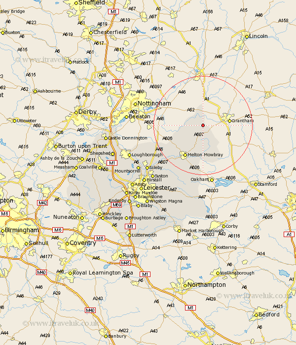
Leicestershire Map Showing Location of Belvoir
Population: 250
District: Melton
Easting: 481861 Northing: 332488
Latitude: 52.88 Longitude: -0.78
 = Belvoir
District: Melton
Easting: 481861 Northing: 332488
Latitude: 52.88 Longitude: -0.78
= Belvoir
This Belvoir map below is supplied by Google. Use the tools in the top left corner to zoom into street level or zoom out for a road map, you may also need to zoom in to see Belvoir on the map. Click and drag the map to move around. If the map fails to load try and refresh your browser or zoom in or out (+ or -).
Update - it seems Google no longer allow people to use their maps for free! This Belvoir map sometimes loads and sometimes gives a error. I am working on a solution.
Closest 30 Towns or Cities to Belvoir (Population over 500)
Redmile 2.17km Stathern 5.81km Eaton 5.99km Bottesford 7.5km Waltham on the Wolds 9.33km Waltham 9.33km Waltham-on-the-Wolds 9.33km Hose 9.6km Scalford 10.82km Abkettley 14.28km Ab Kettleby 14.28km Melton Mowbray 14.6km Wymondham 15.2km Frisby-on-the-Wreak 20.74km Frisby on the Wreak 20.74km Frisby 20.74km Hoby 22.14km Gaddesby 23.82km Wymeswold 24km Wimeswould 24km Somerby 24.32km Rearsby 25.01km Twyford 25.7km Burton on the Wolds 25.88km Burton 25.88km Burton-on-the-Wolds 25.88km Queniborough 27.88km Queniboro 27.88km Sileby 28.22km Syston 29.29km