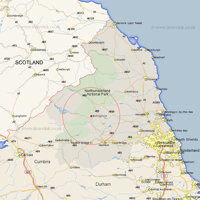
Northumberland Map Showing Location of Bellingham
Population: 1227
District: Tynedale
Easting: 385131 Northing: 583993
Latitude: 55.15 Longitude: -2.23
 = Bellingham
District: Tynedale
Easting: 385131 Northing: 583993
Latitude: 55.15 Longitude: -2.23
= Bellingham
This Bellingham map below is supplied by Google. Use the tools in the top left corner to zoom into street level or zoom out for a road map, you may also need to zoom in to see Bellingham on the map. Click and drag the map to move around. If the map fails to load try and refresh your browser or zoom in or out (+ or -).
Update - it seems Google no longer allow people to use their maps for free! This Bellingham map sometimes loads and sometimes gives a error. I am working on a solution.
Closest 30 Towns or Cities to Bellingham (Population over 500)
Otterburn 8.54km Wark 9.32km Humshaugh 14.45km Challerton 15.5km Chollerton 15.5km Newbrough 16.98km Warden 19.6km Haydon Bridge 20.38km Acomb 20.39km Sandhoe 21.91km Hexham 22.08km Haltwhistle 22.49km Corbridge 24.61km Stamfordham 26.7km Rothbury 28.11km Riding 29.48km Ridingmill 29.48km Slaley 30.58km Ovingham 31km Longhorsley 31.03km Stocksfield 31.43km Wylam 31.8km Longframlington 32.16km Ponteland 32.7km Prudhoe 33.03km Morpeth 34.99km Hebron 35.13km Swarland 35.83km Stannington 36.45km Dinnington 36.72km