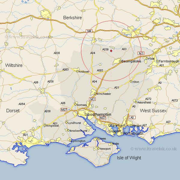
Hampshire Map Showing Location of Baughurst
Population: 2473
District: Basingstoke and Deane
Easting: 458048 Northing: 159741
Latitude: 51.33 Longitude: -1.17
 = Baughurst
District: Basingstoke and Deane
Easting: 458048 Northing: 159741
Latitude: 51.33 Longitude: -1.17
= Baughurst
This Baughurst map below is supplied by Google. Use the tools in the top left corner to zoom into street level or zoom out for a road map, you may also need to zoom in to see Baughurst on the map. Click and drag the map to move around. If the map fails to load try and refresh your browser or zoom in or out (+ or -).
Update - it seems Google no longer allow people to use their maps for free! This Baughurst map sometimes loads and sometimes gives a error. I am working on a solution.
Closest 30 Towns or Cities to Baughurst (Population over 500)
Tadley 2.97km Kingsclere 6.08km Ecchinswell 6.95km Bramley 7.19km Silchester 7.19km Oakley 9.33km Basingstoke 9.4km Burghclere 10.58km Sherfield 11.06km Sherfield upon Loddon 11.06km Highclere 11.58km Basing 11.87km Overton 12.54km North Waltham 14.87km Dummer 14.87km Rotherwick 14.97km Hook 16.79km Whitchurch 17.39km Upton Grey 17.39km East Woodhay 17.46km Odiham 18.68km Hartley Wintney 20.04km Long Sutton 20.77km Winchfield 21.04km Hurstbourne Tarrant 21.04km Wonston 22.9km Barton Stacey 23.17km Longparish 23.28km Micheldever 23.3km Fleet 23.83km