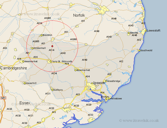
Suffolk Map Showing Location of Barnham
Population: 571
District: St. Edmundsbury
Easting: 586071 Northing: 277852
Latitude: 52.37 Longitude: 0.73
 = Barnham
District: St. Edmundsbury
Easting: 586071 Northing: 277852
Latitude: 52.37 Longitude: 0.73
= Barnham
This Barnham map below is supplied by Google. Use the tools in the top left corner to zoom into street level or zoom out for a road map, you may also need to zoom in to see Barnham on the map. Click and drag the map to move around. If the map fails to load try and refresh your browser or zoom in or out (+ or -).
Update - it seems Google no longer allow people to use their maps for free! This Barnham map sometimes loads and sometimes gives a error. I am working on a solution.
Closest 30 Towns or Cities to Barnham (Population over 500)
Honington 5.86km Troston 6.51km Bardwell 9.68km Ixworth 10.06km Great Barton 11.35km Fornham All Saints 11.35km Barningham 11.47km Brandon 12.18km Stanton 12.61km Hepworth 12.99km Bury St Edmunds 13.03km Bury Saint Edmunds 13.03km Bury St. Edmunds 13.03km Risby 13.03km Pakenham 13.03km Lake Heath 13.52km Lakenheath 13.52km Eriswell 13.58km Hopton 13.58km Thurston 14.16km Mildenhall 14.83km Badwell Ash 15.53km Norton 15.83km Rushbrooke 16.83km Barrow 18km Redgrave 18.11km Bradfield St George 19.08km Bradfield Saint George 19.08km Bradfield 19.08km Bradfield St. George 19.08km