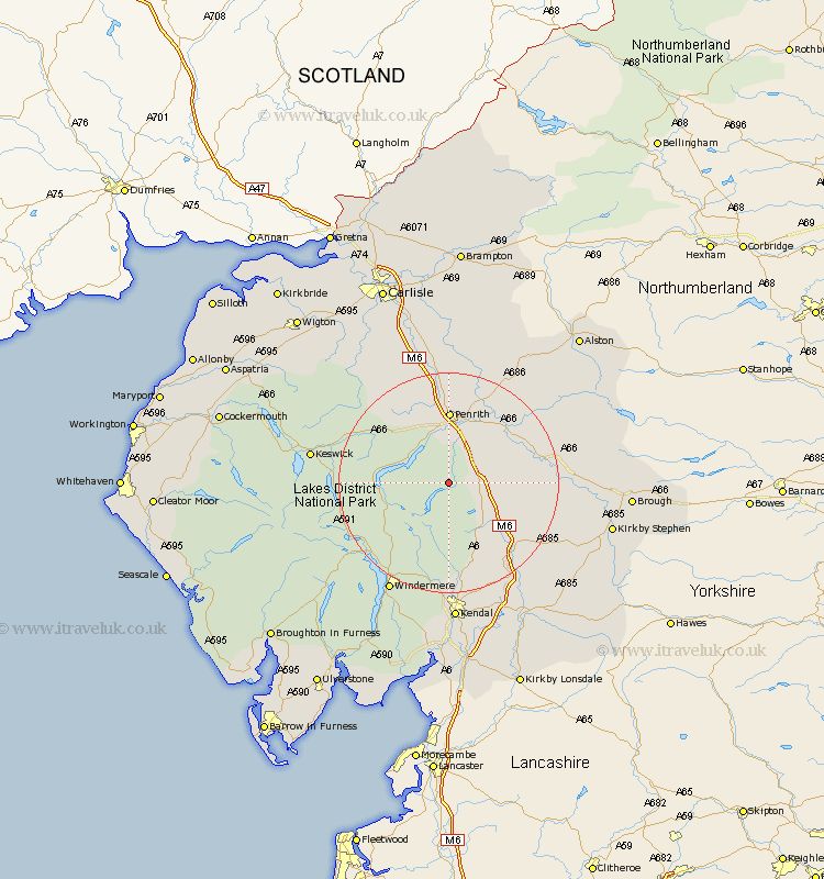
Cumbria Map Showing Location of Bampton
Population: 283
District: Eden
Easting: 350415 Northing: 517478
Latitude: 54.55 Longitude: -2.77
 = Bampton
District: Eden
Easting: 350415 Northing: 517478
Latitude: 54.55 Longitude: -2.77
= Bampton
This Bampton map below is supplied by Google. Use the tools in the top left corner to zoom into street level or zoom out for a road map, you may also need to zoom in to see Bampton on the map. Click and drag the map to move around. If the map fails to load try and refresh your browser or zoom in or out (+ or -).
Update - it seems Google no longer allow people to use their maps for free! This Bampton map sometimes loads and sometimes gives a error. I am working on a solution.
Closest 30 Towns or Cities to Bampton (Population over 500)
Shap 7.44km Dacre 8.57km Crosby Ravensworth 12.39km Greystoke 12.85km Culgaith 15.46km Kirkby Thore 15.81km Orton 15.89km Langwathby 16.16km Long Marston 17.04km Long Marton 17.04km Skelton 17.88km Appleby 18.36km Tebay 18.97km Ambleside 19.66km Staveley 20.64km Lasonby 20.83km Lazonby 20.83km Windermere 22.57km Koswick 23.23km Keswick 23.23km Kirkoswald 24.47km Hawkshead 25.36km Kendall 25.96km Kendal 25.96km Hesket Newmarket 25.97km Ravenstonedale 27.03km Caldbeck 27.35km Ainstable 27.88km Conistan 28.13km Coniston 28.13km