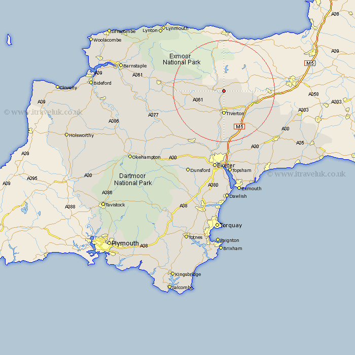
Devon Map Showing Location of Bampton
Population: 1598
District: Mid Devon
Easting: 295890 Northing: 121540
Latitude: 50.98 Longitude: -3.48
 = Bampton
District: Mid Devon
Easting: 295890 Northing: 121540
Latitude: 50.98 Longitude: -3.48
= Bampton
This Bampton map below is supplied by Google. Use the tools in the top left corner to zoom into street level or zoom out for a road map, you may also need to zoom in to see Bampton on the map. Click and drag the map to move around. If the map fails to load try and refresh your browser or zoom in or out (+ or -).
Update - it seems Google no longer allow people to use their maps for free! This Bampton map sometimes loads and sometimes gives a error. I am working on a solution.
Closest 30 Towns or Cities to Bampton (Population over 500)
Sampford Peverell 8.06km Tiverton 9.26km Holcombe Rogus 9.52km Halberton 10.37km Burlescombe 12.24km Willand 13.8km Uffculme 14.01km Cullompton 14.22km Bradninch 17.32km Kentisbeare 17.45km Cheriton Fitzpaine 17.52km Culmstock 17.94km Witheridge 17.95km Silverton 18.53km Hemyock 19.01km Thorverton 20.68km Plymtree 20.75km Sandford 22.55km Broadhembury 22.56km Dunkeswell 22.75km North Molton 23.36km Morchard Bishop 23.86km Payhembury 24.1km Stoke Canon 24.11km Broad Clyst 24.34km South Molton 24.77km Crediton 25.12km Talaton 25.13km St. Cyres 25.44km Saint Cyres 25.44km