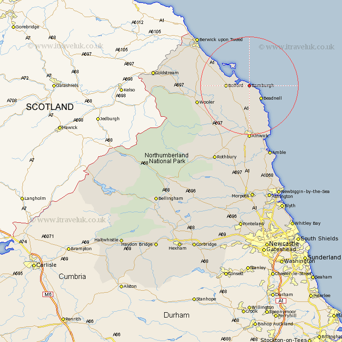
Northumberland Map Showing Location of Bamburgh
Population: 454
District: Berwick-upon-Tweed
Easting: 418901 Northing: 634083
Latitude: 55.6 Longitude: -1.7
 = Bamburgh
District: Berwick-upon-Tweed
Easting: 418901 Northing: 634083
Latitude: 55.6 Longitude: -1.7
= Bamburgh
This Bamburgh map below is supplied by Google. Use the tools in the top left corner to zoom into street level or zoom out for a road map, you may also need to zoom in to see Bamburgh on the map. Click and drag the map to move around. If the map fails to load try and refresh your browser or zoom in or out (+ or -).
Update - it seems Google no longer allow people to use their maps for free! This Bamburgh map sometimes loads and sometimes gives a error. I am working on a solution.
Closest 30 Towns or Cities to Bamburgh (Population over 500)
North Sunderland 4.25km Beadnell 6.96km Belford 8.38km Embleton 14km Lowick 17.15km Wooler 20.27km Ancroft 21.86km Alnwick 22.24km Almwick 22.24km Alnmouth 23.11km Lesbury 24.66km Lisburg 24.66km East Ord 25.93km Ord 25.93km Shilbottle 25.96km Berwick-Upon-Tweed 27.73km Berwick-on-Tweed 27.73km Berwick-upon-Tweed 27.73km Berwick 27.73km Berwick upon Tweed 27.73km Berwick on Tweed 27.73km Warkworth 28.29km Amble 30.55km Norham 31.07km Swarland 33.42km Rothbury 33.93km Felton 35.22km Thirston 35.23km East Thirston 35.23km Longframlington 35.61km