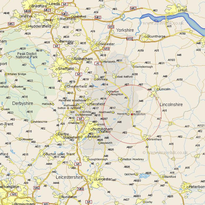
Nottinghamshire Map Showing Location of Balderton
Population: 10298
District: Newark and Sherwood
Easting: 481515 Northing: 352887
Latitude: 53.07 Longitude: -0.78
 = Balderton
District: Newark and Sherwood
Easting: 481515 Northing: 352887
Latitude: 53.07 Longitude: -0.78
= Balderton
This Balderton map below is supplied by Google. Use the tools in the top left corner to zoom into street level or zoom out for a road map, you may also need to zoom in to see Balderton on the map. Click and drag the map to move around. If the map fails to load try and refresh your browser or zoom in or out (+ or -).
Update - it seems Google no longer allow people to use their maps for free! This Balderton map sometimes loads and sometimes gives a error. I am working on a solution.
Closest 30 Towns or Cities to Balderton (Population over 500)
Newark-on-Trent 2.23km Newark on Trent 2.23km Newark 2.23km Newark upon Trent 2.23km Coddington 2.89km Winthorpe 3.7km Farndon 4.83km Muskham 5.99km North Muskham 5.99km Elston 7.87km Fiskerton 8.01km Fiskerton Ferry 8.01km Collingham 9.53km North Collingham 9.53km Bleasby 10.69km Southwell 11.89km Flintham 12.12km East Bridgford 15.75km Aslocton 16.27km Aslockton 16.27km Farnsfield 17.1km Tuxford 17.96km Bilsthorpe 18.26km Bingham 18.56km Oxton 19.03km Burton Joyce 19.12km Shelford 19.16km Woodborough 19.74km Barnstone 20.11km Claverton 20.39km