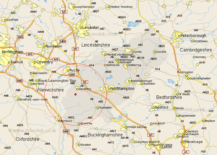
Northamptonshire Map Showing Location of Badby
Population: 645
District: Daventry
Easting: 455787 Northing: 257968
Latitude: 52.22 Longitude: -1.18
 = Badby
District: Daventry
Easting: 455787 Northing: 257968
Latitude: 52.22 Longitude: -1.18
= Badby
This Badby map below is supplied by Google. Use the tools in the top left corner to zoom into street level or zoom out for a road map, you may also need to zoom in to see Badby on the map. Click and drag the map to move around. If the map fails to load try and refresh your browser or zoom in or out (+ or -).
Update - it seems Google no longer allow people to use their maps for free! This Badby map sometimes loads and sometimes gives a error. I am working on a solution.
Closest 30 Towns or Cities to Badby (Population over 500)
Daventry 3.87km Byfield 6.52km Braunston 7.49km Welton 7.75km Weedon Beck 7.95km Weedon 7.95km Upper Boddington 8.8km Boddington 8.8km Flore 9.27km Barby 11.18km Bugbrooke 11.51km Long Buckby 12.2km Chipping Warden 12.49km Pattishall 12.65km Kilsby 13.01km Crick 13.4km Harpole 13.75km East Haddon 14.64km Kislingbury 14.76km West Haddon 15.2km Helmdon 15.22km Gayton 15.78km Chacombe 16.33km Chalcombe 16.33km Towcester 16.49km Greatworth 16.68km Yelvertoft 17.28km Blisworth 17.93km Guilsborough 17.99km Syresham 18.02km