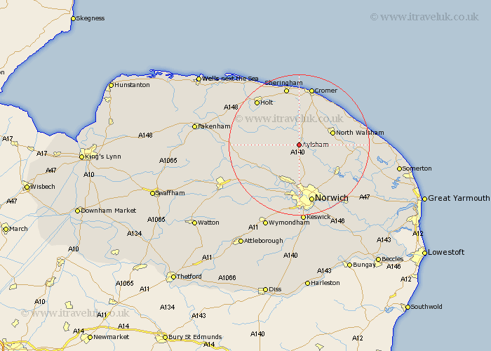
Norfolk Map Showing Location of Aylsham
Population: 4950
Area Size (ha): 172
District: Broadland
Easting: 619146 Northing: 325624
Latitude: 52.78 Longitude: 1.25
 = Aylsham
Area Size (ha): 172
District: Broadland
Easting: 619146 Northing: 325624
Latitude: 52.78 Longitude: 1.25
= Aylsham
This Aylsham map below is supplied by Google. Use the tools in the top left corner to zoom into street level or zoom out for a road map, you may also need to zoom in to see Aylsham on the map. Click and drag the map to move around. If the map fails to load try and refresh your browser or zoom in or out (+ or -).
Update - it seems Google no longer allow people to use their maps for free! This Aylsham map sometimes loads and sometimes gives a error. I am working on a solution.
Closest 30 Towns or Cities to Aylsham (Population over 500)
Aylsham 0km Marsham 1.85km Hevingham 3.87km Erpingham 5.56km Cawston 5.9km Felmingham 5.9km Lammas 6.72km Lamas Little Hautbois 6.72km Little Hautbois 6.72km Hainford 8.13km Haynford 8.13km Corpusty 8.68km Coltishall 9.62km North Walsham 9.7km Reepham 9.7km Horstead 10.01km Witchingham 10.56km Horsford 11.12km Horsham Saint Faith 11.34km Horsham St. Faith 11.34km Horsham St Faith 11.34km Horsham 11.34km Roughton 11.62km Worstead 12.33km Trunch 12.51km Drayton 13.16km Smallburgh 13.58km Rackheath 13.61km Wroxham 13.7km Taverham 13.72km