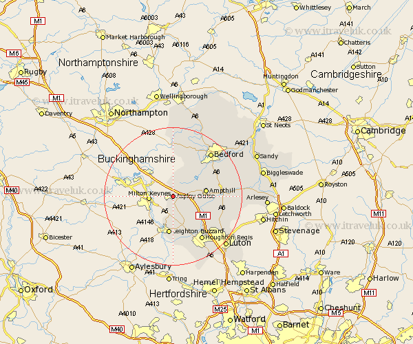
Bedfordshire Map Showing Location of Aspley Guise
Population: 2185
District: Mid Bedfordshire
Easting: 493776 Northing: 236292
Latitude: 52.02 Longitude: -0.63
 = Aspley Guise
District: Mid Bedfordshire
Easting: 493776 Northing: 236292
Latitude: 52.02 Longitude: -0.63
= Aspley Guise
This Aspley Guise map below is supplied by Google. Use the tools in the top left corner to zoom into street level or zoom out for a road map, you may also need to zoom in to see Aspley Guise on the map. Click and drag the map to move around. If the map fails to load try and refresh your browser or zoom in or out (+ or -).
Update - it seems Google no longer allow people to use their maps for free! This Aspley Guise map sometimes loads and sometimes gives a error. I am working on a solution.
Closest 30 Towns or Cities to Aspley Guise (Population over 500)
Woburn 3.89km Lidlington 5.99km Cranfield 6.01km Marston Moretaine 6.8km Ampthill 9.31km Heath and Reach 9.34km Flitwick 10.43km Wootton 10.88km Leighton Buzzard 11.18km Toddington 11.53km Hockliffe 11.64km Westoning 11.68km Houghton Conquest 11.99km Maulden 12.55km Flitton 12.68km Pulloxhill 13.09km Stanbridge 13.42km Kempston 13.82km Elstow 14.68km Wilhamstead 14.77km Willshamstead 14.77km Wilshamstead 14.77km Wilstead 14.77km Clophill 14.83km Billington 14.83km Silsoe 14.95km Houghton Regis 15.24km Haynes 15.28km Biddenham 15.85km Sundon 15.94km