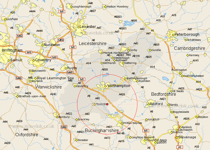
Northamptonshire Map Showing Location of Ashton
Population: 389
District: South Northamptonshire
Easting: 477563 Northing: 248984
Latitude: 52.13 Longitude: -0.87
 = Ashton
District: South Northamptonshire
Easting: 477563 Northing: 248984
Latitude: 52.13 Longitude: -0.87
= Ashton
This Ashton map below is supplied by Google. Use the tools in the top left corner to zoom into street level or zoom out for a road map, you may also need to zoom in to see Ashton on the map. Click and drag the map to move around. If the map fails to load try and refresh your browser or zoom in or out (+ or -).
Update - it seems Google no longer allow people to use their maps for free! This Ashton map sometimes loads and sometimes gives a error. I am working on a solution.
Closest 30 Towns or Cities to Ashton (Population over 500)
Hartwell 1.14km Roade 2.18km Wootton 5.68km Blisworth 5.87km Collingtree 6.01km Milton 6.52km Hackleton 6.52km Paulerspury 7.19km Potterspury 7.49km Hardingstone 7.5km Gayton 7.77km Towcester 7.96km Deanshanger 9.33km Denshanger 9.33km Great Houghton 9.55km Houghton 9.55km Whittlebury 9.72km Denton 10.08km Pattishall 10.89km Kislingbury 11.51km Silverstone 11.66km Yardley Hastings 11.73km Bugbrooke 12.64km Northampton 13.03km Billing 13.42km Great Billing 13.42km Whiston 13.67km Harpole 13.67km Earls Barton 15.22km Bozeat 16.49km