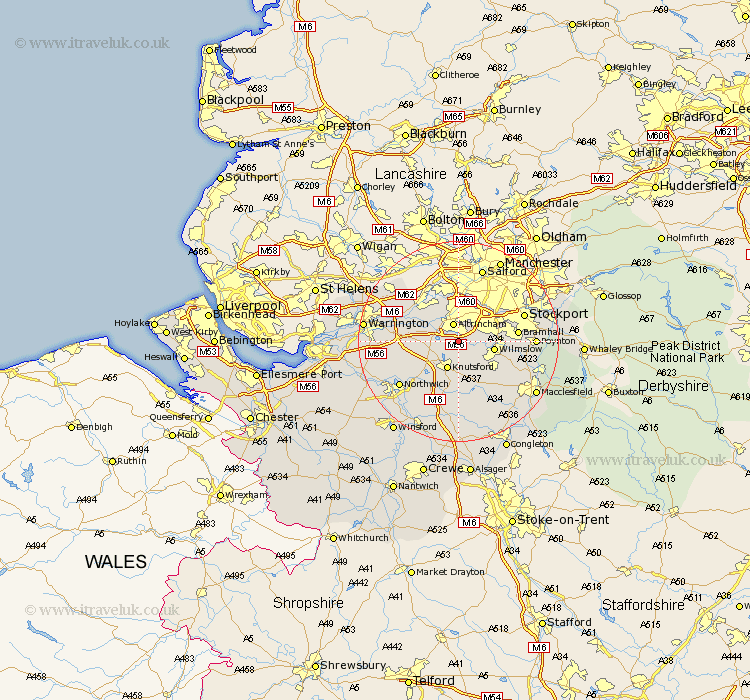
Cheshire Map Showing Location of Ashley
Population: 261
District: Macclesfield
Easting: 377813 Northing: 383760
Latitude: 53.35 Longitude: -2.33
 = Ashley
District: Macclesfield
Easting: 377813 Northing: 383760
Latitude: 53.35 Longitude: -2.33
= Ashley
This Ashley map below is supplied by Google. Use the tools in the top left corner to zoom into street level or zoom out for a road map, you may also need to zoom in to see Ashley on the map. Click and drag the map to move around. If the map fails to load try and refresh your browser or zoom in or out (+ or -).
Update - it seems Google no longer allow people to use their maps for free! This Ashley map sometimes loads and sometimes gives a error. I am working on a solution.
Closest 30 Towns or Cities to Ashley (Population over 500)
Bowdon 2.89km Mobberley 3.86km Altrincham 3.86km Mere 5.84km Knutsford 5.98km Lymm 6.89km Wilmslow 6.89km Sale 7.74km High Legh 7.74km Alderley Edge 8.66km Partington 9.25km Cheadle 9.53km Nether Alderley 9.96km Alderley 9.96km Chelford 10.27km Plumley Station 10.79km Plumbley 10.79km Peover 11.17km Peover Superior 11.17km Bramhall 11.21km Stockton Heath 12.52km Thelwall 12.72km Glazebrook 12.8km Lostock Gralam 12.82km Goostrey 12.98km Stockport 13.37km Adlington 13.79km Risley 14.24km Prestbury 14.26km Prestburg 14.26km