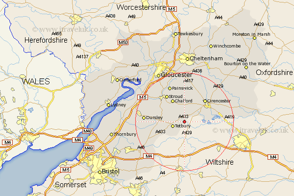
Gloucestershire Map Showing Location of Ashley
Population: 142
District: Cotswold
Easting: 393082 Northing: 194635
Latitude: 51.65 Longitude: -2.1
 = Ashley
District: Cotswold
Easting: 393082 Northing: 194635
Latitude: 51.65 Longitude: -2.1
= Ashley
This Ashley map below is supplied by Google. Use the tools in the top left corner to zoom into street level or zoom out for a road map, you may also need to zoom in to see Ashley on the map. Click and drag the map to move around. If the map fails to load try and refresh your browser or zoom in or out (+ or -).
Update - it seems Google no longer allow people to use their maps for free! This Ashley map sometimes loads and sometimes gives a error. I am working on a solution.
Closest 30 Towns or Cities to Ashley (Population over 500)
Tetbury 4.96km Avening 5.9km Minchinhampton 7.21km Nailsworth 7.83km Horsley 9.91km Chalford 10.34km Siddington 10.99km Woodchester 11.81km Cirencester 12.27km Cicester 12.27km South Cerney 12.78km Cerney 12.78km Stroud 13.08km Uley 15.4km Painswick 15.9km North Cerney 15.9km Ampney St. Peter 15.94km Ampney Saint Peter 15.94km Ampney St Peter 15.94km Ampney 15.94km Dursley 16.2km Randwick 16.59km Stonehouse 16.83km Wotton under Edge 17.35km Wotton-under-Edge 17.35km Coaley 17.71km Hawkesbury 17.74km Cam 18.11km North Nibley 19.63km Slimbridge 20.89km