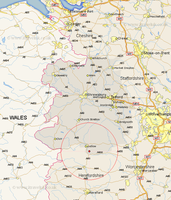
Shropshire Map Showing Location of Ashford Carbonel
Population: 328
District: South Shropshire
Easting: 352307 Northing: 270852
Latitude: 52.33 Longitude: -2.7
 = Ashford Carbonel
District: South Shropshire
Easting: 352307 Northing: 270852
Latitude: 52.33 Longitude: -2.7
= Ashford Carbonel
This Ashford Carbonel map below is supplied by Google. Use the tools in the top left corner to zoom into street level or zoom out for a road map, you may also need to zoom in to see Ashford Carbonel on the map. Click and drag the map to move around. If the map fails to load try and refresh your browser or zoom in or out (+ or -).
Update - it seems Google no longer allow people to use their maps for free! This Ashford Carbonel map sometimes loads and sometimes gives a error. I am working on a solution.
Closest 30 Towns or Cities to Ashford Carbonel (Population over 500)
Caynham 2.93km Ludlow 4.35km Bitterley 8.16km Craven Arms 14.34km Diddlebury 14.88km Cleobury Mortimer 15.73km Bucknell 17.38km Wistanstow 17.99km Rushbury 20.42km Ditton Priors 20.62km Kinlet 21.35km Lydbury North 22.53km North Lydbury 22.53km Clun 24.45km Church Stretton 25.03km Highley 25.1km Alveley 27.06km Bridgnorth 29.39km Much Wenlock 31.35km Worfield 33.03km Barrow Bridge 33.61km Barrow 33.61km Shelve 33.78km Cressage 33.83km Broseley 34.76km Claverley 35.07km Berrington 35.22km Condover 35.38km Minsterley 36.91km Ironbridge 36.91km