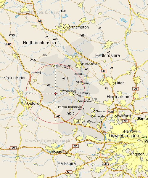
Buckinghamshire Map Showing Location of Ashendon
Population: 248
District: Aylesbury Vale
Easting: 471220 Northing: 213673
Latitude: 51.82 Longitude: -0.97
 = Ashendon
District: Aylesbury Vale
Easting: 471220 Northing: 213673
Latitude: 51.82 Longitude: -0.97
= Ashendon
This Ashendon map below is supplied by Google. Use the tools in the top left corner to zoom into street level or zoom out for a road map, you may also need to zoom in to see Ashendon on the map. Click and drag the map to move around. If the map fails to load try and refresh your browser or zoom in or out (+ or -).
Update - it seems Google no longer allow people to use their maps for free! This Ashendon map sometimes loads and sometimes gives a error. I am working on a solution.
Closest 30 Towns or Cities to Ashendon (Population over 500)
Waddesdon 3.9km Cuddington 5.06km Long Crendon 5.68km Chearsley 5.68km Brill 5.73km Grendon Underwood 6.01km Quainton 6.53km Haddenham 6.54km Oakley 7.12km Stone 8.23km Worminghall 8.85km Warminghall 8.85km North Marston 10.1km Marsh Gibbon 10.89km Aylesbury 11.46km Whitchurch 11.78km Whitechurch 11.78km Longwick 12.27km Claydon 13.02km Steeple Claydon 13.02km Bledlow 13.08km Stoke Mandeville 13.14km Twyford 13.75km Ellesborough 14.63km Great Kimble 14.75km Kimble 14.75km Princes Risborough 15.17km Weston Turville 15.36km Wendover 15.91km Winslow 16.33km