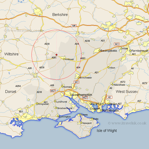
Hampshire Map Showing Location of Appleshaw
Population: 487
District: Test Valley
Easting: 430250 Northing: 148381
Latitude: 51.23 Longitude: -1.57
 = Appleshaw
District: Test Valley
Easting: 430250 Northing: 148381
Latitude: 51.23 Longitude: -1.57
= Appleshaw
This Appleshaw map below is supplied by Google. Use the tools in the top left corner to zoom into street level or zoom out for a road map, you may also need to zoom in to see Appleshaw on the map. Click and drag the map to move around. If the map fails to load try and refresh your browser or zoom in or out (+ or -).
Update - it seems Google no longer allow people to use their maps for free! This Appleshaw map sometimes loads and sometimes gives a error. I am working on a solution.
Closest 30 Towns or Cities to Appleshaw (Population over 500)
Thruxton 3.88km Tangley 5.09km Abbots Ann 6.56km Abbotts Ann 6.56km Andover 6.88km Upper Clatford 8.04km Vernhams Dean 8.19km Vernham Dean 8.19km Hurstbourne Tarrant 8.93km Goodworth Clatford 9.41km Lower Clatford 9.41km Clatford 9.41km Over Wallop 11.36km Longparish 12.87km Nether Wallop 12.97km Chilbolton 13.12km Barton Stacey 15.78km Stockbridge 15.92km Whitchurch 16.35km East Woodhay 16.65km Broughton 16.72km Kings Somborne 19.42km Highclere 19.67km Burghclere 19.71km Wonston 19.73km Overton 22.05km Sparsholt 22.51km Michlemersh 22.72km Michelmersh 22.72km Ecchinswell 23.64km