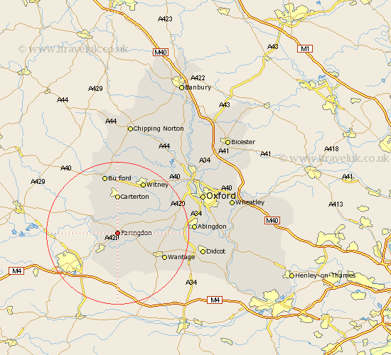
Oxfordshire Map Showing Location of Faringdon
Population: 5104
Area Size (ha): 116
District: Vale of White Horse
Easting: 428824 Northing: 194712
Latitude: 51.65 Longitude: -1.58
 = Faringdon
Area Size (ha): 116
District: Vale of White Horse
Easting: 428824 Northing: 194712
Latitude: 51.65 Longitude: -1.58
= Faringdon
This Faringdon map below is supplied by Google. Use the tools in the top left corner to zoom into street level or zoom out for a road map, you may also need to zoom in to see Faringdon on the map. Click and drag the map to move around. If the map fails to load try and refresh your browser or zoom in or out (+ or -).
Update - it seems Google no longer allow people to use their maps for free! This Faringdon map sometimes loads and sometimes gives a error. I am working on a solution.
Closest 30 Towns or Cities to Faringdon (Population over 500)
Clanfield 5.56km Buckland 6.04km Stanford in the Vale 6.04km Watchfield 6.54km Shrivenham 7.22km Uffington 7.77km Bampton 8.18km Childrey 10.13km Longworth 10.99km Carterton 11.12km Kingston Bagpuize 11.64km Kingston Bagpuze 11.64km East Challow 11.82km Brize Norton 13.02km Shilton 13.03km Letcombe Regis 13.06km Ducklington 13.08km Hanney 13.18km East Hanney 13.18km Standlake 13.68km Wantage 14.67km Stanton Harcourt 15.67km Witney 16.35km Minster Lovell 17.03km Burford 17.03km Marcham 17.25km Hailey 18.05km Cumnor 18.76km Steventon 18.77km Leafield 18.85km