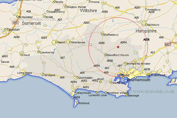
Dorset Map Showing Location of Farnham
Population: 204
District: North Dorset
Easting: 396485 Northing: 113085
Latitude: 50.92 Longitude: -2.05
 = Farnham
District: North Dorset
Easting: 396485 Northing: 113085
Latitude: 50.92 Longitude: -2.05
= Farnham
This Farnham map below is supplied by Google. Use the tools in the top left corner to zoom into street level or zoom out for a road map, you may also need to zoom in to see Farnham on the map. Click and drag the map to move around. If the map fails to load try and refresh your browser or zoom in or out (+ or -).
Update - it seems Google no longer allow people to use their maps for free! This Farnham map sometimes loads and sometimes gives a error. I am working on a solution.
Closest 30 Towns or Cities to Farnham (Population over 500)
Handley 5.1km Tarrant Monkton 6.03km Pimperne 6.92km Charlton 9.43km Iwerne Minster 9.53km Cranborne 9.53km Blandford 9.89km Blandford Forum 9.89km Fontmell Magna 10.05km Horton 10.21km Stourpaine 11.15km Spetisbury 12.06km Wimborne Minster 12.75km Wimborne 12.75km Child Okeford 12.85km Verwood 14.01km Shaftesbury 14.01km Shillingstone 14.15km Corfe Mullen 14.88km Sturminster Marshall 14.88km Alderholt 15.19km West Moors 15.31km Winterborne Stickland 15.86km Stickland Winterborne 15.86km Motcombe 16.12km Sturminster Newton 16.36km St. Leonards 16.82km St Leonards 16.82km Saint Leonards 16.82km Stour Provost 17.95km