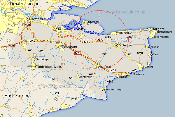
Kent Map Showing Location of Faversham
Population: 16804
Area Size (ha): 380
District: Swale
Easting: 602065 Northing: 161559
Latitude: 51.32 Longitude: 0.9
 = Faversham
Area Size (ha): 380
District: Swale
Easting: 602065 Northing: 161559
Latitude: 51.32 Longitude: 0.9
= Faversham
This Faversham map below is supplied by Google. Use the tools in the top left corner to zoom into street level or zoom out for a road map, you may also need to zoom in to see Faversham on the map. Click and drag the map to move around. If the map fails to load try and refresh your browser or zoom in or out (+ or -).
Update - it seems Google no longer allow people to use their maps for free! This Faversham map sometimes loads and sometimes gives a error. I am working on a solution.
Closest 30 Towns or Cities to Faversham (Population over 500)
Oare 1.16km Ospringe 2.97km Selling 5.68km Teynham 6.08km Dunkirk 6.88km Lynsted 8.32km Linsted 8.32km Warden 9.26km Bapchild 9.27km Leysdown on Sea 9.34km Leysdown 9.34km Leysdown-on-Sea 9.34km Eastchurch 9.55km Harbledown 9.99km Chilham 10.37km Sittingbourne 10.58km Blean 10.59km Doddington 10.81km Chartham 10.99km Chestfield 12.16km Minster 12.53km Whitstable 12.7km Tunstall 12.74km Iwade 12.84km Canterbury 12.85km Hackington 13.28km Borden 13.9km Bredgar 14.03km Bobbing 14.38km Queenborough 14.47km