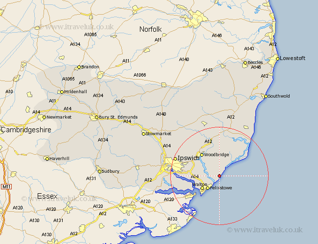
Suffolk Map Showing Location of Alderton
Population: 421
District: Suffolk Coastal
Easting: 634412 Northing: 240922
Latitude: 52.02 Longitude: 1.42
 = Alderton
District: Suffolk Coastal
Easting: 634412 Northing: 240922
Latitude: 52.02 Longitude: 1.42
= Alderton
This Alderton map below is supplied by Google. Use the tools in the top left corner to zoom into street level or zoom out for a road map, you may also need to zoom in to see Alderton on the map. Click and drag the map to move around. If the map fails to load try and refresh your browser or zoom in or out (+ or -).
Update - it seems Google no longer allow people to use their maps for free! This Alderton map sometimes loads and sometimes gives a error. I am working on a solution.
Closest 30 Towns or Cities to Alderton (Population over 500)
Hollesley 3.87km Kirton 7.09km Kirkton 7.09km Sutton 7.19km Felixstowe 7.19km Walton 8.64km Martlesham Heath 10.68km Orford 10.89km Martlesham 10.89km Rendlesham 11.12km Melton 11.51km Woodbridge 11.51km Bucklesham 11.55km Ufford 12.02km Nacton 12.55km Shotley 12.69km Tunstall 13.16km Chelmondiston 14.19km Grundisburgh 14.68km Wickham Market 15.21km Holbrook 17.51km Wirnesham 18.45km Witnesham 18.45km Ipswich 18.63km Stutton 19.09km Snape 19.38km Aldeburgh 19.41km Otley 19.41km Henley 21.35km Thorpe 21.56km