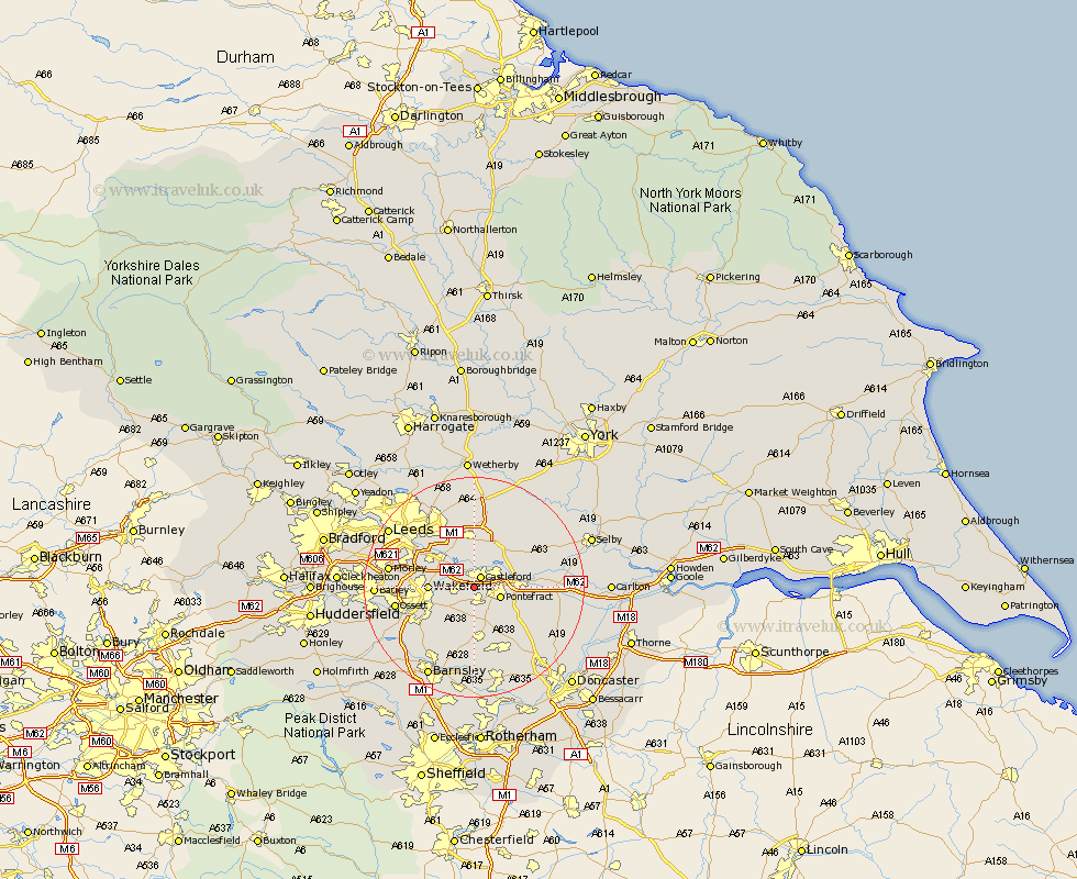
Yorkshire Map Showing Location of Featherstone
Population: 10324
Area Size (ha): 197
District: Wakefield
Easting: 441808 Northing: 422829
Latitude: 53.7 Longitude: -1.37
 = Featherstone
Area Size (ha): 197
District: Wakefield
Easting: 441808 Northing: 422829
Latitude: 53.7 Longitude: -1.37
= Featherstone
This Featherstone map below is supplied by Google. Use the tools in the top left corner to zoom into street level or zoom out for a road map, you may also need to zoom in to see Featherstone on the map. Click and drag the map to move around. If the map fails to load try and refresh your browser or zoom in or out (+ or -).
Update - it seems Google no longer allow people to use their maps for free! This Featherstone map sometimes loads and sometimes gives a error. I am working on a solution.
Closest 30 Towns or Cities to Featherstone (Population over 500)
Castleford 2.16km Normanton 3.29km Pontefract 4.77km High Ackworth 5.98km Ackworth Moor Top 5.98km Ackworth 5.98km Crofton 6.46km Brotherton 6.84km Kippax 7.42km Fitzwilliam 7.5km Wakefield 7.68km Stanley 7.68km Swillington 8.11km Darrington 8.53km Knottingley 8.78km Knottingly 8.78km Garforth 9.33km Rothwell 9.48km Lofthouse 9.52km Badsworth 10.25km Ryhill 10.25km Monk Fryston 10.39km South Milford 10.67km Upton 10.77km Hemsworth 11.17km Micklefield 11.33km North Elmsall 12.04km Royston 12.4km Horbury 12.63km Aberford 13.16km