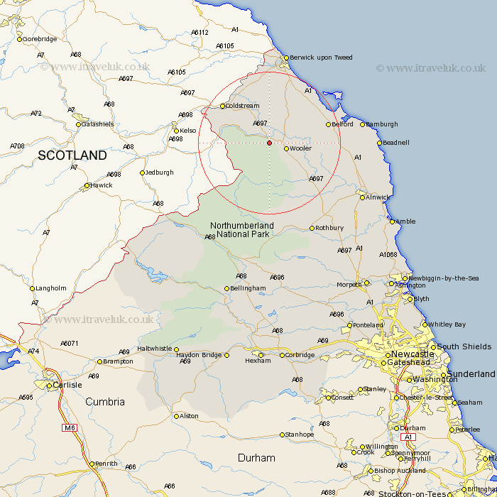
Northumberland Map Showing Location of Akeld
Population: 82
District: Berwick-upon-Tweed
Easting: 395794 Northing: 628480
Latitude: 55.55 Longitude: -2.07
 = Akeld
District: Berwick-upon-Tweed
Easting: 395794 Northing: 628480
Latitude: 55.55 Longitude: -2.07
= Akeld
This Akeld map below is supplied by Google. Use the tools in the top left corner to zoom into street level or zoom out for a road map, you may also need to zoom in to see Akeld on the map. Click and drag the map to move around. If the map fails to load try and refresh your browser or zoom in or out (+ or -).
Update - it seems Google no longer allow people to use their maps for free! This Akeld map sometimes loads and sometimes gives a error. I am working on a solution.
Closest 30 Towns or Cities to Akeld (Population over 500)
Wooler 4.59km Lowick 11.19km Belford 15.69km Ancroft 17.2km Norham 19.26km East Ord 22.46km Ord 22.46km North Sunderland 25.22km Berwick on Tweed 26.28km Berwick upon Tweed 26.28km Berwick-Upon-Tweed 26.28km Berwick 26.28km Berwick-upon-Tweed 26.28km Berwick-on-Tweed 26.28km Beadnell 27.26km Rothbury 27.99km Alnwick 28.5km Almwick 28.5km Embleton 29.28km Shilbottle 31.62km Alnmouth 33.81km Lisburg 33.88km Lesbury 33.88km Longframlington 34.63km Swarland 34.86km Warkworth 36.05km Otterburn 37.6km Felton 37.62km Thirston 38.27km East Thirston 38.27km