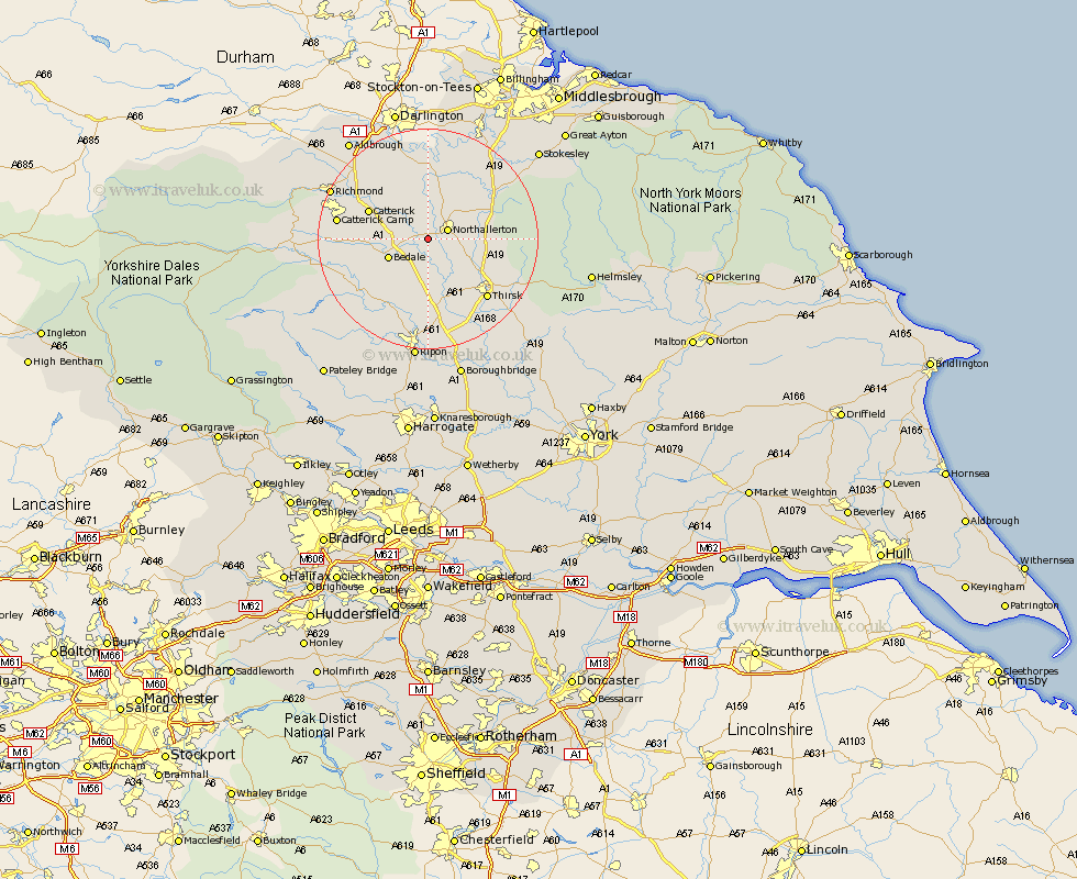
Yorkshire Map Showing Location of Ainderby
Population: 212
District: Hambleton
Easting: 433606 Northing: 491374
Latitude: 54.32 Longitude: -1.48
 = Ainderby
District: Hambleton
Easting: 433606 Northing: 491374
Latitude: 54.32 Longitude: -1.48
= Ainderby
This Ainderby map below is supplied by Google. Use the tools in the top left corner to zoom into street level or zoom out for a road map, you may also need to zoom in to see Ainderby on the map. Click and drag the map to move around. If the map fails to load try and refresh your browser or zoom in or out (+ or -).
Update - it seems Google no longer allow people to use their maps for free! This Ainderby map sometimes loads and sometimes gives a error. I am working on a solution.
Closest 30 Towns or Cities to Ainderby (Population over 500)
Northallerton 3.73km Brompton 5.69km Bedale 7.48km Crakehall 8.85km North Cowton 10.22km Scorton 10.58km Catterick 11.2km East Cowton 11.58km Cowton 11.58km Osmotherley 13.12km West Tanfield 14.06km Tanfield 14.06km Thirsk 14.78km Masham 15.52km Topcliffe 16.19km Middleton Tyas 18.34km Grewelthorpe 18.36km Richmond 18.66km Whorlton 18.76km Dishforth 19.04km Barton 19.87km Kirkby Malzeard 19.89km Gilling 19.91km Leyburn 21.7km Middleton 21.79km Middleton upon Leven 21.79km Middleham 21.95km Ripon 22.34km Melsonby 22.6km Seamer 24.01km