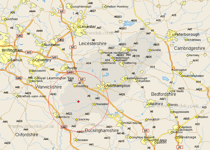
Northamptonshire Map Showing Location of Adstone
Population: 84
District: South Northamptonshire
Easting: 459292 Northing: 250590
Latitude: 52.15 Longitude: -1.13
 = Adstone
District: South Northamptonshire
Easting: 459292 Northing: 250590
Latitude: 52.15 Longitude: -1.13
= Adstone
This Adstone map below is supplied by Google. Use the tools in the top left corner to zoom into street level or zoom out for a road map, you may also need to zoom in to see Adstone on the map. Click and drag the map to move around. If the map fails to load try and refresh your browser or zoom in or out (+ or -).
Update - it seems Google no longer allow people to use their maps for free! This Adstone map sometimes loads and sometimes gives a error. I am working on a solution.
Closest 30 Towns or Cities to Adstone (Population over 500)
Byfield 7.07km Helmdon 7.42km Badby 8.16km Pattishall 8.17km Weedon 8.7km Weedon Beck 8.7km Bugbrooke 9.7km Chipping Warden 9.83km Syresham 9.87km Greatworth 9.87km Upper Boddington 10.4km Boddington 10.4km Towcester 10.4km Flore 10.87km Silverstone 10.88km Daventry 11.35km Gayton 11.52km Whittlebury 12.65km Chacombe 12.65km Chalcombe 12.65km Brackley 13.03km Kislingbury 13.57km Blisworth 13.77km Harpole 13.8km Welton 14.87km Milton 15.23km Braunston 15.5km Paulerspury 15.54km Collingtree 16.34km Roade 17.06km