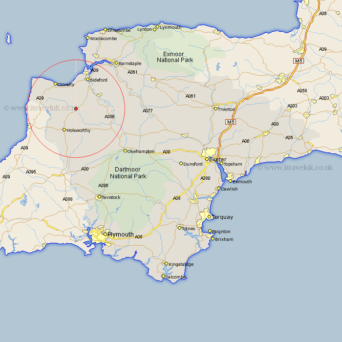
Devon Map Showing Location of Abbots Bickington
Population: 35
District: Torridge
Easting: 239459 Northing: 113713
Latitude: 50.9 Longitude: -4.28
 = Abbots Bickington
District: Torridge
Easting: 239459 Northing: 113713
Latitude: 50.9 Longitude: -4.28
= Abbots Bickington
This Abbots Bickington map below is supplied by Google. Use the tools in the top left corner to zoom into street level or zoom out for a road map, you may also need to zoom in to see Abbots Bickington on the map. Click and drag the map to move around. If the map fails to load try and refresh your browser or zoom in or out (+ or -).
Update - it seems Google no longer allow people to use their maps for free! This Abbots Bickington map sometimes loads and sometimes gives a error. I am working on a solution.
Closest 30 Towns or Cities to Abbots Bickington (Population over 500)
Langtree 6.13km Bradworthy 7.01km Shebbear 7.26km Parkham 7.51km Buckland Brewer 7.78km Woolfardisworthy 10.2km Woolsery 10.2km Holsworthy 10.38km Torrington 10.87km Great Torrington 10.87km Black Torrington 11.62km Bideford 13.79km Pyworthy 13.81km Halwill 15.23km Bridgerule 15.31km Northam 15.54km Dolton 17.63km Appledore 17.67km Hatherleigh 17.81km Hartland 17.89km Ashwater 18.54km Instow 18.57km Northlew 18.89km High Bickington 21.2km Fremington 21.9km Braunton 23.31km Tawstock 23.35km Burrington 23.66km Barrington 23.66km Broadwoodwidger 24.21km