Suffolk Map Showing Location of Kirton
Population: 1086
District: Suffolk Coastal
Easting: 627638 Northing: 238748
Latitude: 52 Longitude: 1.32
 = Kirton
District: Suffolk Coastal
Easting: 627638 Northing: 238748
Latitude: 52 Longitude: 1.32
= Kirton
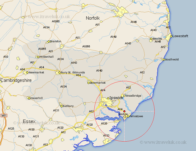
This Kirton map below is supplied by Google. Use the tools in the top left corner to zoom into street level or zoom out for a road map, you may also need to zoom in to see Kirton on the map. Click and drag the map to move around. If the map fails to load try and refresh your browser or zoom in or out (+ or -).
Update - it seems Google no longer allow people to use their maps for free! This Kirton map sometimes loads and sometimes gives a error. I am working on a solution.
Closest 30 Towns or Cities to Kirton (Population over 500)
Walton 3.71km Felixstowe 4.35km Bucklesham 5.88km Shotley 5.88km Nacton 6km Chelmondiston 7.09km Martlesham Heath 7.76km Sutton 7.76km Martlesham 9.33km Hollesley 9.73km Holbrook 10.44km Melton 11.12km Woodbridge 11.12km Stutton 12km Grundisburgh 12.02km Ufford 13.17km Ipswich 13.82km Wirnesham 14.38km Witnesham 14.38km Rendlesham 14.67km Sprughton 15.83km Sproughton 15.83km Bentley 16.08km Claydon 16.52km Bramford 16.57km Wickham Market 17.03km Capel St Mary 17.11km Capel St. Mary 17.11km Capel 17.11km Capel Saint Mary 17.11km