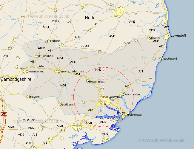
Suffolk Map Showing Location of Whitton
Population: 105
District: Mid Suffolk
Easting: 614658 Northing: 247450
Latitude: 52.08 Longitude: 1.13
 = Whitton
District: Mid Suffolk
Easting: 614658 Northing: 247450
Latitude: 52.08 Longitude: 1.13
= Whitton
This Whitton map below is supplied by Google. Use the tools in the top left corner to zoom into street level or zoom out for a road map, you may also need to zoom in to see Whitton on the map. Click and drag the map to move around. If the map fails to load try and refresh your browser or zoom in or out (+ or -).
Update - it seems Google no longer allow people to use their maps for free! This Whitton map sometimes loads and sometimes gives a error. I am working on a solution.
Closest 30 Towns or Cities to Whitton (Population over 500)
Claydon 1.14km Ipswich 2.28km Bramford 2.93km Great Blakenham 2.94km Henley 3.88km Witnesham 3.89km Wirnesham 3.89km Sproughton 4.35km Sprughton 4.35km Coddenham 5.67km Somersham 5.99km Hintlesham 6.79km Grundisburgh 8.18km Bucklesham 9.72km Nacton 10.08km Otley 10.08km Capel St Mary 10.32km Capel 10.32km Capel Saint Mary 10.32km Capel St. Mary 10.32km Martlesham Heath 10.42km Great Bricett 10.9km Holbrook 11.35km Martlesham 11.39km Bentley 11.63km Ringshall 11.65km Chelmondiston 12.5km Woodbridge 12.66km Melton 12.66km Stutton 13.02km