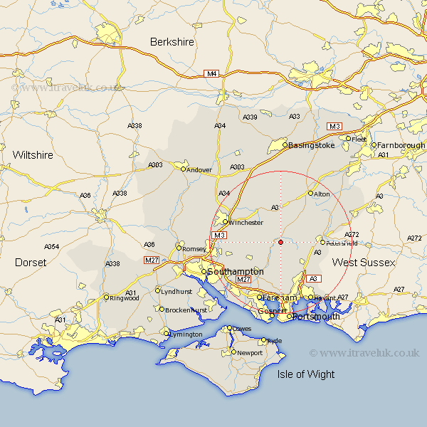
Hampshire Map Showing Location of Warnford
Population: 220
District: Winchester
Easting: 463146 Northing: 122735
Latitude: 51 Longitude: -1.1
 = Warnford
District: Winchester
Easting: 463146 Northing: 122735
Latitude: 51 Longitude: -1.1
= Warnford
This Warnford map below is supplied by Google. Use the tools in the top left corner to zoom into street level or zoom out for a road map, you may also need to zoom in to see Warnford on the map. Click and drag the map to move around. If the map fails to load try and refresh your browser or zoom in or out (+ or -).
Update - it seems Google no longer allow people to use their maps for free! This Warnford map sometimes loads and sometimes gives a error. I am working on a solution.
Closest 30 Towns or Cities to Warnford (Population over 500)
West Meon 2.19km Bramdean 3.88km Corhampton 4.38km East Meon 5.02km Droxford 6.03km Froxfield 7.24km Cheriton 7.26km Ropley 7.51km Soberton 7.78km Swanmore 8.76km Hambledon 9.55km Bishop's Waltham 9.88km Bishops Waltham 9.88km Upham 10.04km Clanfield 10.2km New Alresford 10.37km Shidfield 10.95km Shedfield 10.95km Buriton 11.13km Waltham Chase 11.62km Petersfield 11.66km Owslebury 11.66km Steep 11.81km Durley 11.88km Wickham 12.06km Horndean 12.35km Medstead 13.18km Four Marks 13.44km Upper Farringdon 13.79km Faringdon 13.79km