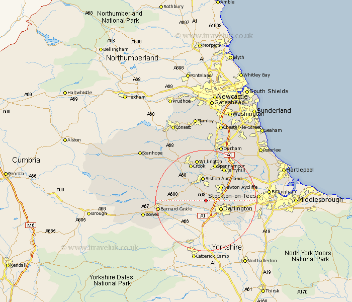
Durham Map Showing Location of Walworth
Population: 107
Easting: 422627 Northing: 519122
Latitude: 54.57 Longitude: -1.65
 = Walworth
Easting: 422627 Northing: 519122
Latitude: 54.57 Longitude: -1.65
= Walworth
This Walworth map below is supplied by Google. Use the tools in the top left corner to zoom into street level or zoom out for a road map, you may also need to zoom in to see Walworth on the map. Click and drag the map to move around. If the map fails to load try and refresh your browser or zoom in or out (+ or -).
Update - it seems Google no longer allow people to use their maps for free! This Walworth map sometimes loads and sometimes gives a error. I am working on a solution.
Closest 30 Towns or Cities to Walworth (Population over 500)
Gainford 5.68km Darlington 6.53km Shildon 7.41km Newton Aycliffe 7.73km West Auckland 9.15km Bishop Auckland 9.32km Evenwood 9.35km Staindrop 9.67km Coundon 11.12km Cockfield 11.15km High Etherley 11.28km Etherley 11.28km Hurworth 12.65km Stillington 14.45km Ferryhill 14.48km Spennymoor 15.09km Crook 15.76km Carlton 16.22km Sedgefield 16.75km Bishop Middleham 16.83km Willington 16.99km West Cornforth 17.13km Cornforth 17.13km Barnard Castle 17.59km Startforth 17.59km Grindon 18.06km Stockton-on-Tees 19km Stockton on Tees 19km Stockton 19km Fishburn 19.04km