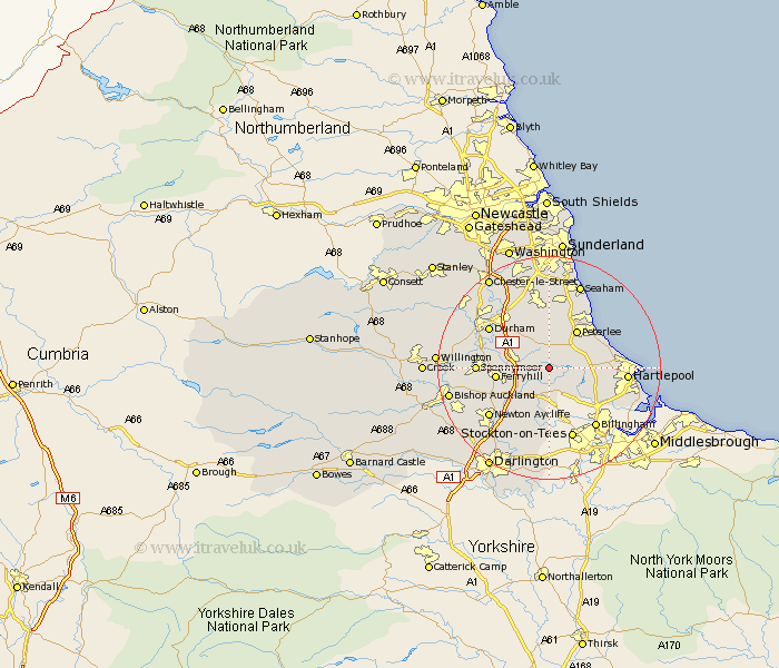
Durham Map Showing Location of Trimdon
Population: 3032
Area Size (ha): 59
District: Sedgefield
Easting: 437588 Northing: 534053
Latitude: 54.7 Longitude: -1.42
 = Trimdon
Area Size (ha): 59
District: Sedgefield
Easting: 437588 Northing: 534053
Latitude: 54.7 Longitude: -1.42
= Trimdon
This Trimdon map below is supplied by Google. Use the tools in the top left corner to zoom into street level or zoom out for a road map, you may also need to zoom in to see Trimdon on the map. Click and drag the map to move around. If the map fails to load try and refresh your browser or zoom in or out (+ or -).
Update - it seems Google no longer allow people to use their maps for free! This Trimdon map sometimes loads and sometimes gives a error. I am working on a solution.
Closest 30 Towns or Cities to Trimdon (Population over 500)
Fishburn 2.14km Wingate 4.28km Bishop Middleham 4.67km Hutton Henry 4.67km Sedgefield 5.66km Thornley 5.66km Coxhoe 5.67km West Cornforth 6.42km Cornforth 6.42km Bowburn 7.42km Peterlee 8.22km Hesleden 8.49km Sherburn 8.56km Ferryhill 8.77km Elwick 8.77km Haswell 9.26km Grindon 9.51km Shotton 9.8km Hart 9.81km Easington 10.18km Horden 10.21km Shincliffe 10.54km Stillington 11.17km South Hetton 11.17km Spennymoor 11.78km Pittington 11.91km Durham 12.16km Wolviston 12.62km Murton 12.98km Hartlepool 12.99km