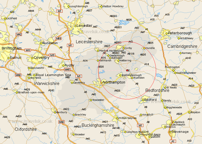
Northamptonshire Map Showing Location of Finedon
Population: 3972
Area Size (ha): 97
District: Wellingborough
Easting: 493112 Northing: 271501
Latitude: 52.33 Longitude: -0.63
 = Finedon
Area Size (ha): 97
District: Wellingborough
Easting: 493112 Northing: 271501
Latitude: 52.33 Longitude: -0.63
= Finedon
This Finedon map below is supplied by Google. Use the tools in the top left corner to zoom into street level or zoom out for a road map, you may also need to zoom in to see Finedon on the map. Click and drag the map to move around. If the map fails to load try and refresh your browser or zoom in or out (+ or -).
Update - it seems Google no longer allow people to use their maps for free! This Finedon map sometimes loads and sometimes gives a error. I am working on a solution.
Closest 30 Towns or Cities to Finedon (Population over 500)
Irthlingborough 2.92km Burton Latimer 2.93km Isham 4.89km Higham Ferrers 5.03km Wellingborough 5.85km Woodford 5.85km Stanwick 5.96km Ringstead 5.96km Rushden 6.52km Raunds 6.79km Irchester 7.41km Great Doddington 8.68km Doddington 8.68km Islip 8.78km Wilby 9.33km Kettering 9.33km Wollaston 9.54km Broughton 9.79km Thrapston 10.06km Sywell 11.61km Geddington 11.63km Earls Barton 12.2km Walgrave 12.46km Titchmarsh 12.6km Bozeat 13.16km Brigstock 13.17km Overstone 13.65km Whiston 13.66km Rothwell 14.63km Rowell 14.63km