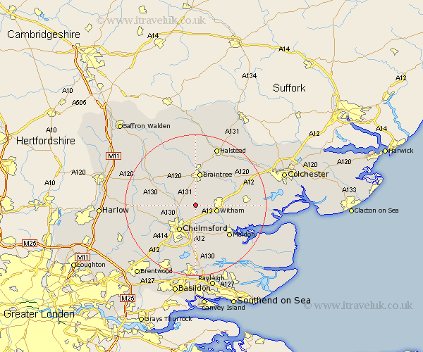
Essex Map Showing Location of Terling
Population: 774
District: Braintree
Easting: 575807 Northing: 214386
Latitude: 51.8 Longitude: 0.55
 = Terling
District: Braintree
Easting: 575807 Northing: 214386
Latitude: 51.8 Longitude: 0.55
= Terling
This Terling map below is supplied by Google. Use the tools in the top left corner to zoom into street level or zoom out for a road map, you may also need to zoom in to see Terling on the map. Click and drag the map to move around. If the map fails to load try and refresh your browser or zoom in or out (+ or -).
Update - it seems Google no longer allow people to use their maps for free! This Terling map sometimes loads and sometimes gives a error. I am working on a solution.
Closest 30 Towns or Cities to Terling (Population over 500)
Great Leighs 2.95km Boreham 3.7km Hatfield Peverel 3.91km Little Waltham 4.58km Black Notley 5.56km Witham 6.02km Cressing 6.54km Broomfield 6.82km Great Waltham 7.12km Little Baddow 7.5km Rayne 7.76km Wickham Bishops 8.24km Bradwell 8.72km Chelmsford 8.72km Rivenhall 8.83km Braintree 9.33km Panfield 9.54km Totham 10.31km Great Totham 10.31km Stisted 10.33km Kelvedon 10.96km Danbury 11.18km Great Baddow 11.64km Barnston 11.71km Felsted 11.71km Coggeshall 11.79km Heybridge 11.8km Writtle 12.26km Woodham Mortimer 12.51km Galleywood 12.51km