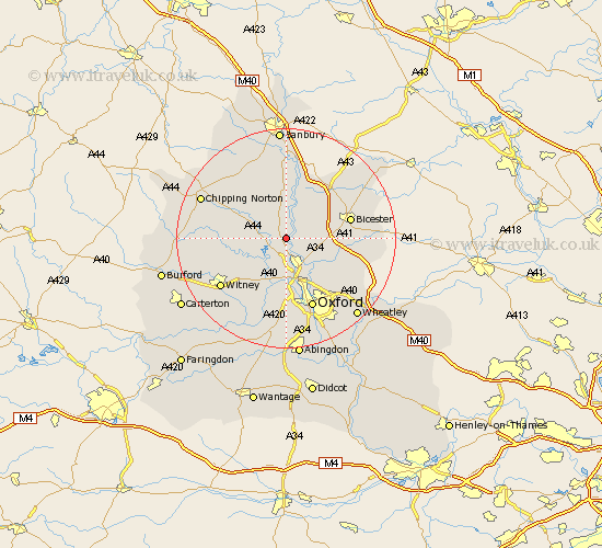
Oxfordshire Map Showing Location of Tackley
Population: 958
District: West Oxfordshire
Easting: 447045 Northing: 218949
Latitude: 51.87 Longitude: -1.32
 = Tackley
District: West Oxfordshire
Easting: 447045 Northing: 218949
Latitude: 51.87 Longitude: -1.32
= Tackley
This Tackley map below is supplied by Google. Use the tools in the top left corner to zoom into street level or zoom out for a road map, you may also need to zoom in to see Tackley on the map. Click and drag the map to move around. If the map fails to load try and refresh your browser or zoom in or out (+ or -).
Update - it seems Google no longer allow people to use their maps for free! This Tackley map sometimes loads and sometimes gives a error. I am working on a solution.
Closest 30 Towns or Cities to Tackley (Population over 500)
Woodstock 1.86km Kirtlington 3.43km Bletchingdon 3.9km Steeple Aston 5.68km Bladon 6.01km Kidlington 6.01km Duns Tew 7.49km Yarnton 7.5km Islip 7.98km Upper Heyford 8.17km Church Handborough 8.72km Hanborough 8.72km Stonesfield 8.83km Chesterton 9.34km Cassington 9.55km Ardley 10.1km Charlbury 10.3km Enstone 10.71km Fritwell 10.88km North Leigh 10.92km Bicester 12.02km Ensham 12.03km Eynsham 12.03km Caversfield 12.68km Deddington 12.97km Beckley 13.04km Barford St John 13.41km Barford 13.41km Barford St. John 13.41km Barford Saint John 13.41km