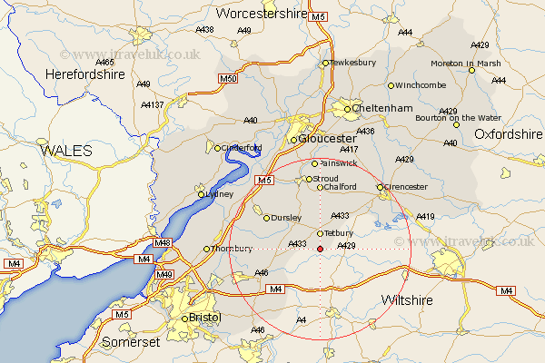
Gloucestershire Map Showing Location of Shipton Moyne
Population: 328
District: Cotswold
Easting: 388457 Northing: 189083
Latitude: 51.6 Longitude: -2.17
 = Shipton Moyne
District: Cotswold
Easting: 388457 Northing: 189083
Latitude: 51.6 Longitude: -2.17
= Shipton Moyne
This Shipton Moyne map below is supplied by Google. Use the tools in the top left corner to zoom into street level or zoom out for a road map, you may also need to zoom in to see Shipton Moyne on the map. Click and drag the map to move around. If the map fails to load try and refresh your browser or zoom in or out (+ or -).
Update - it seems Google no longer allow people to use their maps for free! This Shipton Moyne map sometimes loads and sometimes gives a error. I am working on a solution.
Closest 30 Towns or Cities to Shipton Moyne (Population over 500)
Tetbury 3.7km Avening 9.26km Nailsworth 9.54km Horsley 10.34km Minchinhampton 11.12km Hawkesbury 11.66km Wotton under Edge 13.19km Wotton-under-Edge 13.19km Dursley 13.69km Woodchester 13.77km Uley 13.89km Chalford 14.82km Wickwar 15.08km North Nibley 16.69km Chipping Sodbury 16.71km Stroud 16.84km Cam 16.84km Coaley 17.34km Charfield 17.36km Siddington 17.59km Stonehouse 18.52km South Cerney 18.78km Cerney 18.78km Marshfield 19.06km Randwick 19.41km Cicester 19.48km Cirencester 19.48km Cromhall 19.65km Slimbridge 19.79km Falfield 19.91km