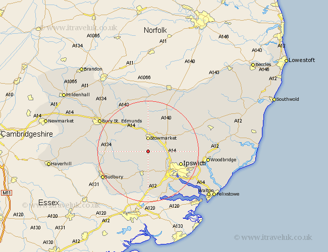
Suffolk Map Showing Location of Ringshall
Population: 619
District: Mid Suffolk
Easting: 604156 Northing: 252576
Latitude: 52.13 Longitude: 0.98
 = Ringshall
District: Mid Suffolk
Easting: 604156 Northing: 252576
Latitude: 52.13 Longitude: 0.98
= Ringshall
This Ringshall map below is supplied by Google. Use the tools in the top left corner to zoom into street level or zoom out for a road map, you may also need to zoom in to see Ringshall on the map. Click and drag the map to move around. If the map fails to load try and refresh your browser or zoom in or out (+ or -).
Update - it seems Google no longer allow people to use their maps for free! This Ringshall map sometimes loads and sometimes gives a error. I am working on a solution.
Closest 30 Towns or Cities to Ringshall (Population over 500)
Great Bricett 1.85km Great Finborough 5.04km Finborough 5.04km Stowmarket 5.56km Bildeston 5.87km Somersham 5.87km Hitcham 5.98km Great Blakenham 8.78km Rattlesden 8.8km Coddenham 9.1km Haughley 9.27km Hadleigh 9.54km Old Newton 9.55km Hintlesham 10.32km Claydon 10.67km Woolpit 10.88km Bramford 10.88km Henley 11.53km Elmswell 12.01km Sprughton 12.22km Sproughton 12.22km Layham 13.01km Lavenham 13.05km Ipswich 13.7km Cockfield 13.77km Wirnesham 14.15km Witnesham 14.15km Mendlesham 14.17km Bradfield St. George 14.54km Bradfield 14.54km