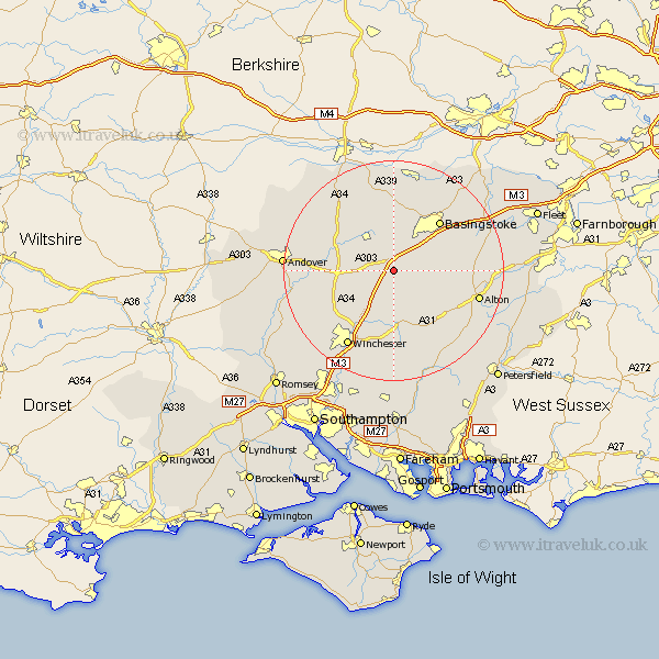
Hampshire Map Showing Location of Popham
Population: 44
District: Basingstoke and Deane
Easting: 455908 Northing: 143036
Latitude: 51.18 Longitude: -1.2
 = Popham
District: Basingstoke and Deane
Easting: 455908 Northing: 143036
Latitude: 51.18 Longitude: -1.2
= Popham
This Popham map below is supplied by Google. Use the tools in the top left corner to zoom into street level or zoom out for a road map, you may also need to zoom in to see Popham on the map. Click and drag the map to move around. If the map fails to load try and refresh your browser or zoom in or out (+ or -).
Update - it seems Google no longer allow people to use their maps for free! This Popham map sometimes loads and sometimes gives a error. I am working on a solution.
Closest 30 Towns or Cities to Popham (Population over 500)
North Waltham 2.19km Dummer 3.95km Overton 6.56km Micheldever 7.25km Oakley 7.51km Wonston 8.94km Whitchurch 10km New Alresford 11.36km Barton Stacey 11.76km Medstead 11.89km Basingstoke 12.33km Four Marks 12.82km Kings Worthy 13.13km Longparish 13.94km Upton Grey 14.42km Basing 14.86km Cheriton 15km Kingsclere 15.24km Ropley 15.31km Alton 16.1km Winchester 16.26km Chilbolton 16.69km Baughurst 16.84km Burghclere 16.91km Ecchinswell 17.31km Bramley 17.5km Bramdean 17.66km Farringdon 17.73km Faringdon 17.73km Upper Farringdon 17.73km