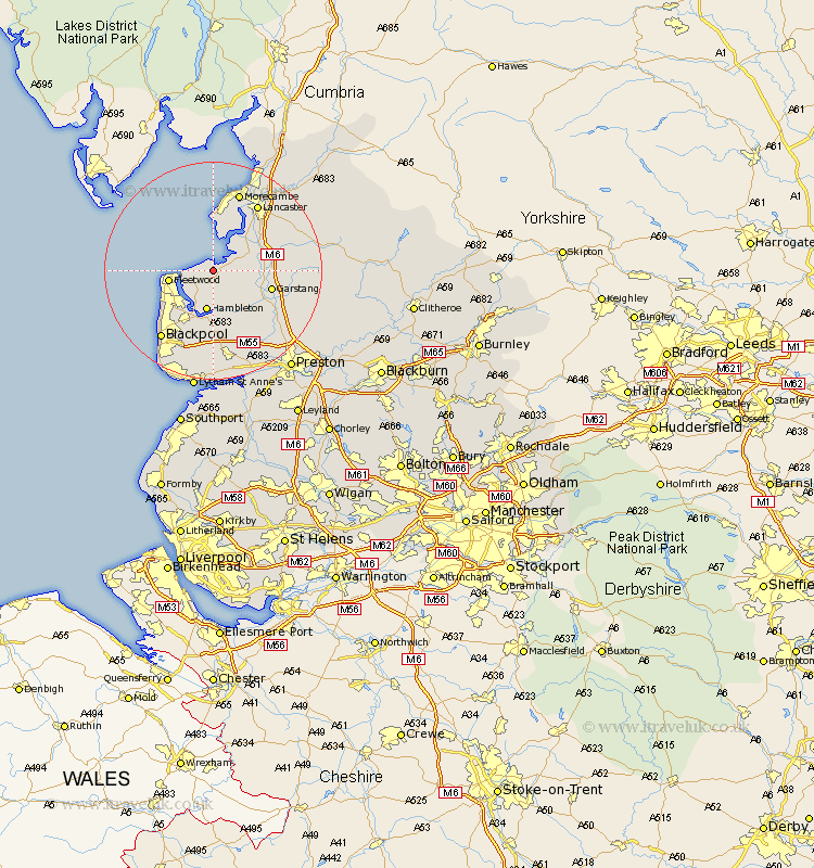
Lancashire Map Showing Location of Pilling
Population: 1739
District: Wyre
Easting: 339823 Northing: 448986
Latitude: 53.93 Longitude: -2.92
 = Pilling
District: Wyre
Easting: 339823 Northing: 448986
Latitude: 53.93 Longitude: -2.92
= Pilling
This Pilling map below is supplied by Google. Use the tools in the top left corner to zoom into street level or zoom out for a road map, you may also need to zoom in to see Pilling on the map. Click and drag the map to move around. If the map fails to load try and refresh your browser or zoom in or out (+ or -).
Update - it seems Google no longer allow people to use their maps for free! This Pilling map sometimes loads and sometimes gives a error. I am working on a solution.
Closest 30 Towns or Cities to Pilling (Population over 500)
Preesall 3.76km Cockerham 6.8km Hambleton 7.49km Fleetwood 7.65km Middleton 7.73km Overton 8.6km Forton 8.92km Great Eccleston 9.83km Eccleston 9.83km Thornton 9.89km Garstang 10.5km Great Singleton 11.17km Singleton 11.17km Elswick 11.33km Cleveleys 11.45km Poulton le Fylde 11.95km Poulton 11.95km Catterall 12.31km Inskip 12.39km Lancaster 14.63km Claughton-on-Brock 15.05km Claughton on Brock 15.05km Claughton 15.05km Morecombe 15.46km Morecambe 15.46km Blackpool 15.64km Plumpton 16.71km Kirkham 17km Barton 17.68km Broughton 17.68km