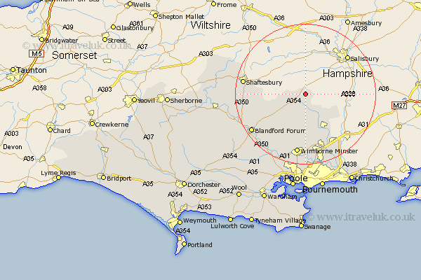
Dorset Map Showing Location of Pentridge
Population: 215
District: East Dorset
Easting: 403510 Northing: 118648
Latitude: 50.97 Longitude: -1.95
 = Pentridge
District: East Dorset
Easting: 403510 Northing: 118648
Latitude: 50.97 Longitude: -1.95
= Pentridge
This Pentridge map below is supplied by Google. Use the tools in the top left corner to zoom into street level or zoom out for a road map, you may also need to zoom in to see Pentridge on the map. Click and drag the map to move around. If the map fails to load try and refresh your browser or zoom in or out (+ or -).
Update - it seems Google no longer allow people to use their maps for free! This Pentridge map sometimes loads and sometimes gives a error. I am working on a solution.
Closest 30 Towns or Cities to Pentridge (Population over 500)
Handley 3.96km Cranborne 7.78km Alderholt 9.89km Verwood 12.56km Charlton 12.97km Horton 12.98km Tarrant Monkton 14.53km Pimperne 15.85km St. Leonards 16.41km Saint Leonards 16.41km St Leonards 16.41km Fontmell Magna 16.45km Iwerne Minster 16.76km West Moors 17.04km Wimborne Minster 17.58km Wimborne 17.58km Shaftesbury 17.89km Blandford Forum 18.82km Blandford 18.82km Fern Down 19.44km Ferndown 19.44km Motcombe 19.47km Stourpaine 19.82km Spetisbury 20.37km Child Okeford 20.62km Corfe Mullen 21.21km Sturminster Marshall 21.98km Shillingstone 22.29km West Parley 22.99km Parley 22.99km