Dorset Map Showing Location of Parkstone
Easting: 404706 Northing: 90851
Latitude: 50.72 Longitude: -1.93
 = Parkstone
Latitude: 50.72 Longitude: -1.93
= Parkstone
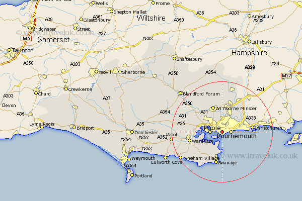
This Parkstone map below is supplied by Google. Use the tools in the top left corner to zoom into street level or zoom out for a road map, you may also need to zoom in to see Parkstone on the map. Click and drag the map to move around. If the map fails to load try and refresh your browser or zoom in or out (+ or -).
Update - it seems Google no longer allow people to use their maps for free! This Parkstone map sometimes loads and sometimes gives a error. I am working on a solution.
Closest 30 Towns or Cities to Parkstone (Population over 500)
Bournemouth 3.52km Poole 4.69km West Parley 7.27km Parley 7.27km Arne 7.28km Studland 9.27km Lytchett Matravers 10.09km Corfe Mullen 10.22km Ferndown 10.38km Fern Down 10.38km Holton Heath Station 10.56km Holton Heath 10.56km Wimborne Minster 10.96km Wimborne 10.96km West Moors 11.36km Christchurch 11.88km Sturminster Marshall 11.95km Corfe Castle 12.39km Burton 13.04km Swanage 13.19km Wareham 13.44km St. Leonards 14.23km Saint Leonards 14.23km St Leonards 14.23km Langton Matravers 14.24km Worth Matravers 14.77km Worth 14.77km Horton 14.87km Spetisbury 17.03km Verwood 17.32km